Northcentral Region Regulated Trout Waters
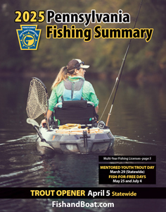
Statewide Opening Day of Trout Season
Opening Day: April 5
Stocked Trout Waters

– New Addition

– Section(s) of this Stocked Trout Water is also managed under Miscellaneous Special Regulations.
– This red keystone indicates that this water is a Keystone Select Stocked Trout Water. The Keystone Select Stocked Trout Waters program provides anglers with an exciting opportunity to fish for larger trout. Under the program, approximately 10,000 large trout, 2- to 3-years old and measuring between 14 to 20 inches, are distributed among these select waters under the Delayed Harvest Artificial Lures Only Special Regulations and one water managed with Miscellaneous Special Regulations. These larger trout are stocked only during the spring stocking periods to coincide with the period of peak angler use. As with many waters managed with Delayed Harvest Artificial Lures Only and Miscellaneous Special Regulations, not all waters in the Keystone Select Stocked Trout Waters program receive a fall stocking. Fall stocking is limited to stream sections that are considered destination fisheries and provide relatively high angler use during fall. Currently, 16 of the 24 stream sections in this program receive a fall stocking.
Cameron:
- Clear Creek (Mud Run to mouth)
- Driftwood Branch Sinnemahoning Creek (Shippen township building to mouth)
- East Branch Cowley Run (Cowley Road bridge to mouth)
- First Fork Sinnemahoning Creek (headwaters to mouth)
- Mix Run (Red Run to mouth)
- North Creek (Fivemile Run to mouth)
- Sinnemahoning Portage Creek (SR 0155 bridge near Sizer Run to mouth)
- West Branch Cowley Run (Fee Run to mouth)
- Wykoff Run (Big Spring Draft to mouth)
Centre:
- Bald Eagle Creek (Bell Hollow Road bridge to inlet of Sayers Lake near the Boggs-Howard Township line)
- Big Poe Creek (Poe Lake to mouth)
- Black Moshannon Creek (Black Moshannon Dam to unnamed tributary downstream to Gorton Road)
- Cold Stream Dam
- Harvest Fields Ponds
- Little Fishing Creek (fourth bridge upstream SR 0064 bridge, Hublersburg, to mouth)
- Marsh Creek (unnamed tributary 0.5 mile upstream Manntown Road to mouth)
- Penns Creek (SR 0045 to Elk Creek)
- Pine Creek (Stony Run Road bridge to Bald Eagle State Forest boundary)
- Poe Lake
- Sinking Creek (Colyer Lake Dam to mouth)
- Sixmile Run (Clay Mine Road to mouth)
- South Fork Beech Creek (Private Pond to SR 0080)
- Standing Stone Creek (Penn Roosevelt Dam to first SR 0026 bridge north of Huntingdon)
- Wallace Run (unnamed tributary at Gumstump to 0.25 mile upstream to ballfield)
- White Deer Creek (powerline crossing 125 meters upstream Black Gap Road to White Deer dam)
- Wolf Run (Wolf Run Trail to Little Wolf Run)
Clearfield:
- Anderson Creek (Dubois Reservoir to unnamed tributary 1,000 meters downstream SR 0322)
- Bennett Branch Sinnemahoning Creek (South Branch Bennett Branch to Wilson Run)
- Chest Creek (confluence with unnamed tributary Bradley junction to mouth)
- Curry Run (Webb Road bridge to mouth)
- East Branch Mahoning Creek (Beech Run to 1 kilometer downstream Branch Road bridge)
- Gazzam Run (headwaters to mouth)
- Gifford Run (Merrill Road bridge to Lost Run Road bridge)
- Goss Run Dam
- Janesville Dam
- Juniata Lake (Tannery Dam)
- Laborde Branch (T-899 bridge near junction SR 4016 to 700 meters downstream SR 4016 bridge)
- Laurel Run (Parker Lake Dam to Abbot Run)
- Laurel Run (Jeep Road near pond to mouth)
- Little Clearfield Creek (confluence Watts Creek and Gazzam Run to 0.4 mile downstream of the T-584 bridge)
- Little Muddy Run (SR 0253 bridge to confluence unnamed tributary 1.7 kilometers upstream mouth)
- Medix Run (Jack Dent Branch to mouth)
- Moose Creek (first unnamed tributary 0.7 kilometer downstream Moose Creek Reservoir to mouth)
- Mosquito Creek (Grimes Run to mouth)
- North Witmer Run (Hunter Run to mouth)
- Parker Lake
- Shaggers Inn Pond
- South Witmer Run (pipe crossing at State Game Lands #120 to mouth)
- Stony Run Pond
- Wilson Run (Barrett Run to mouth)
- Wolf Run (State Game Lands to mouth)
Clinton:
- Cooks Run (end of Road near Lick Run to Rock Run)
- Fishing Creek (Cedar Run to Country Club Road bridge Mill Hall)
- Hyner Run (Power line crossing upstream Hyner Run State Park to mouth)
- Kettle Creek (Long Run to Slide Hollow)
- Left Branch Young Womans Creek (Forest Road bridge to mouth)
- Little Fishing Creek (fourth bridge upstream SR 0064 bridge, Hublersburg, to mouth)
- Young Womans Creek (County Line Branch to mouth)
Elk:
- Bear Creek (Maple Run to mouth)
- Belmouth Run (State Game Lands boundary bridge crossing to mouth)
- Bennett Branch
- Sinnemahoning Creek (Jay/Benezette Township Line to 300 meters downstream Station Road bridge)
- Big Mill Creek (SR 0948 bridge to Rockey Run and Ridgway Reservoir to mouth)
- Boggy Run (dam at headwaters to mouth)
- Byrnes Run (unnamed tributary 1,000 meters upstream Auman Hollow to mouth)
- Crooked Creek (500 meters upstream Long Branch to SR 1004 bridge)
- Dents Run (Hodag Trail crossing to mouth)
- East Branch Clarion River (State Game Land boundary 1.15 miles downstream of East Branch Dam to Indian Run)
- East Branch Millstone Creek (0.5 miles upstream Loleta Road bridge to mouth)
- East Branch Spring Creek (headwaters to Pigs Ear bridge)
- Elk Creek (Water Tank Run to mouth)
- Hicks Run (confluence East and West Branch Hicks Run to mouth)
- Hoffman Run (Dam to mouth)
- Laurel Run Reservoir
- Little Toby Creek (Mead Run to mouth)
- Maxwell Run (Civilian Conservation Corps Road near headwaters to 1.5 miles downstream SR 0949)
- Mead Run (unnamed tributary at Shawmut to mouth)
- Medix Run (Jack Dent Branch to mouth)
- Millstone Creek (confluence East and West Branch to mouth)
- Mix Run (Red Run to mouth)
- Powers Run (SR 1001 bridge to mouth)
- Ridgway Reservoir
- Rocky Run (tributary 1,500 meters downstream county line to mouth)
- Spring Creek (East Branch Spring Creek to mouth)
- Twin Lakes
- West Branch Clarion River (SR 0219 bridge north of Halsey to Silver Creek Road)
- West Branch Hicks Run (Shaffer Draft Road to mouth)
- Wilson Run (McKean/Elk County Line to mouth)
- Wolf Run (T-317 bridge nearest Route 66 to mouth)
Jefferson:
- Big Run (T-506 bridge to T-519 bridge)
- Big Run (second bridge upstream junction T-374 and SR 3014 to mouth)
- Callen Run (3.8 kilometers upstream Johns Run to mouth)
- Canoe Creek (Painter Run to mouth)
- Cathers Run (220 meters upstream Cathers Run Road to mouth)
- Clear Creek (Trap Run to mouth)
- Clear Run (T-486 bridge to mouth)
- Cloe Lake
- East Branch Mahoning Creek (Beech Run to 1 kilometer downstream Branch Road bridge)
- Fivemile Run (T-830 bridge upstream Colon to T-830 bridge 100 meters upstream Swamp Run)
- Laurel Run (Jeep Road near pond to mouth)
- Little Sandy Creek (SR 0236 bridge to mouth)
- Little Toby Creek (Mead Run to mouth)
- Mill Creek (T-342 bridge to Little Mill Creek)
- Mill Creek (T-550 bridge, Reitz, to mouth)
- North Fork Redbank Creek (Hetrick Run to Pekin Run and first tributary downstream Rose and Eldred Township Line to mouth)
- Pekin Run (Mays Road bridge to mouth)
- Rattlesnake Creek (450 meters upstream Siple Road bridge to mouth)
- Rattlesnake Run (SR 1015 bridge to mouth)
- Redbank Creek (North Fork Redbank Creek to Little Sandy Creek)
- Sandy Lick Creek (Schoolhouse Run to Fivemile Run)
- Walburn Run (confluence East and West Branch Walburn Run to mouth)
- Wolf Run (State Game Lands to mouth)
Lycoming:
- Hoagland Run (Big Sandy Run to mouth)
- Larrys Creek (first SR 973 bridge upstream Salladasburg to mouth)
- Little Bear Creek (Red Run to mouth)
- Little Muncy Creek (SR 0118 bridge to Big Run, Lairdsville)
- Little Pine Creek (0.4 mile upstream Bonnell Run to mouth)
- Loyalsock Creek (0.25 mile upstream Rock Run Road to SR 973)
- Lycoming Creek (Roaring Brook to Hoagland Run)
- Mill Creek (Warrensville) (700 meters upstream Sugar Camp Road to first Warrensville Road bridge downstream Warrensville)
- Muncy Creek (Peters Creek to Little Muncy Creek)
- Pleasant Stream (Potash Hollow to mouth)
- Rock Run (Hawk Run to mouth)
- Spring Creek (SR 2001 bridge to mouth)
- White Deer Hole Creek (State Forest Boundary to Bob Drick Road (T-464) bridge)
McKean:
- Allegheny River (Seven bridges to Allegheny Portage Creek)
- Bell Run (Chapman Brook Run to Wingard Hollow Run)
- Bradford City Number Three Reservoir
- Chappel Fork (Bucklick Run to mouth)
- Combs Creek (Strang Hollow Run to mouth)
- East Branch Tionesta Creek (T-300 bridge downstream Jojo to mouth)
- Hamlin Lake
- Havens Run (Pigeon Hollow to mouth)
- Kinzua Creek (dam 0.8 mile upstream SR 3009 Kushequa to 200 meters downstream Allegheny National Forest Road 15)
- Marvin Creek (T-450 bridge to SR 6)
- North Branch Sugar Run (Railroad Run to mouth)
- Potato Creek (confluence East Branch Potato and Havens Run to Marvin Creek)
- Red Mill Brook (Sergeant Norwich Township line to mouth)
- Sevenmile Run (350 meters upstream pipeline at two tributaries to mouth)
- Skinner Creek (Sherwood Hollow to mouth)
- South Branch Kinzua Creek (Hubert Run to mouth)
- Sugar Run (Kavanaugh Run to mouth)
- Twomile Run (headwaters to mouth)
- West Branch Clarion River (SR 219 bridge north of Halsey to Silver Creek Road)
- West Branch Potato Creek (confluence West and South forks to mouth)
- Willow Creek (headwaters to Willow Bay bridge)
Montour:
- Mahoning Creek (from SR 0054 to mouth)
- Mauses Creek (first dirt road upstream Old Furnace Road to mouth)
- Roaring Creek (Lick Run to mouth)
- NORTHUMBERLAND:
- Little Shamokin Creek (T-445 to Foye Road bridge and transmission line crossing upstream intersection of Comfort and Miller roads to mouth)
- Mahantango Creek (Route 125 bridge to Kiwanis Farm Road bridge)
- Schwaben Creek (Moyer Road to Mouse Creek)
- South Branch Roaring Creek (Jepko/Campground Road to mouth)
- Zerbe Run Rod & Gun Club Pond
Potter:
- Allegheny River (Seven Bridges to Allegheny Portage Creek)
- Bailey Run (120 meters upstream Little Bailey Run to mouth)
- Cowanesque River (Dodge Hollow to Troupes Creek)
- East Branch Cowley Run (Cowley Road bridge to mouth)
- East Branch Fishing Creek (Jeep Trail 0.2 mile upstream SR 4005 to mouth)
- East Fork Sinnemahoning Creek (Mud Lick Run to mouth)
- Elevenmile Creek (Turkey Path Road bridge to mouth)
- First Fork Sinnemahoning Creek (headwaters to mouth)
- Fishing Creek (Fisk Hollow to mouth)
- Genesee River (Ludington Run to state line)
- Kettle Creek (Long Run to Slide Hollow)
- Little Kettle Creek (Bloss Hollow to mouth)
- Lyman Run (Lyman Run Lake to mouth)
- Lyman Run Lake
- Oswayo Creek (Clara Creek to Horse Run Road)
- Pine Creek (Genesee Forks to 0.5 mile downstream Campbells Run)
- South Branch Oswayo Creek (T-354 bridge to mouth)
- South Woods Branch (Heth Run to mouth)
- West Branch Cowley Run (Fee Run to mouth)
- West Branch Pine Creek (Lyman Run to mouth)
Snyder:
- Beaver Creek (0.5 mile downstream Snyder Avenue near Three Rivers Church to mouth)
- Kern Run (Brick Plant Road bridge upstream Beavertown to mouth)
- Middle Creek (Black Mountain Road bridge to SR 4008 bridge near Faylor Lake inflow and 0.3 mile upstream Pine Swamp Road to 0.5 mile downstream SR 0522 in Middleburg)
- North Branch Mahantango Creek (Heister Valley Road bridge near Township line to Swamp Road bridge near Aline)
- North Branch Middle Creek (Clarence F. Walker Lake to mouth)
- South Branch Middle Creek (Steeky Road to mouth)
- Swift Run (Sandhill Road to mouth)
- West Branch Mahantango Creek (Crater Hill Road to Creek Road and Stream Ford)
Tioga:
- Charleston Creek (Outflow Hamilton Lake to mouth)
- Corey Creek (Route 6 bridge, Mainesburg, to Newtown Hill Road)
- Cowanesque River (Dodge Hollow to Troupes Creek)
- Crooked Creek (Hills Creek Road to Ives Run Lane)
- East Branch Stony Fork (Draper Village to mouth)
- Long Run (Blue Run to mouth)
- Marsh Creek (Lower Marsh Creek Road to mouth)
- Mill Creek (Sopertown Road to mouth)
- Pine Creek (Genesee Forks to 0.5 mile downstream Campbells Run)
- Stony Fork (confluence East Branch and West Branch Stony Fork to mouth)
- Tioga River (Tioga/Bradford County Line to Fall Brook)
Union:
- Buffalo Creek (Aikey Road bridge to Rapid Run)
- Halfway Lake
- Laurel Run (SR 0235 bridge to mouth)
- Limestone Run (Second SR 45 bridge upstream of mouth to mouth)
- North Branch Buffalo Creek (Mifflinburg Reservoir to mouth)
- Penns Creek (downstream end of island near Jolly Grove Lane to Creek Road bridge near Libby Road)
- Rapid Run (Walbash Road bridge to mouth)
- Spring Creek (SR 2001 bridge to mouth)
- White Deer Creek (0.7 mile upstream Dyer Road to mouth)
Stocked Trout Waters Open to Year-Round Fishing
Cameron:
- George B. Stevenson Reservoir
- West Creek (SR 1008 at Rathbun downstream to SR 3001 at Howard Siding)
Clearfield:
- West Branch Susquehanna River (SR 1001 bridge near Hyde to first Railroad bridge downstream of the confluence with Moose Creek)
- West Branch Susquehanna River (Anderson Creek to SR 2024 crossing at Porters bridge)
Clinton:
- Kettle Creek Lake
Elk:
- West Creek (SR 1008 at Rathbun downstream to SR 3001 at Howard Siding)
Lycoming:
- Little Pine Lake
- Pine Creek (Bonnell Run at DCNR Clark Farm Access Area downstream to the confluence with Little Pine Creek)
Lycoming/Tioga:
- Pine Creek (from SR 0414 bridge in Blackwell downstream to the confluence with Slate Run)
McKean:
- Meade Run (Blacksnake Run to mouth)
Tioga:
- Beechwood Lake
- Hamilton Lake
Catch and Release Artificial Lures Only
Cameron:
- Hunts Run (4.7 miles; from confluence with McNuff Branch downstream to the mouth)
Clinton:
- Fishing Creek (5.3 miles; from the private lane bridge at the Tylersville State Fish Hatchery downstream to Fleming’s Bridge, SR 2004, at the Lamar Fish Hatchery)
- Rauchtown Creek (1.12 miles; from the confluence of Rockey Run and Krape Run downstream to the SR 0880 crossing upstream of the Ravensburg St. Park Picnic Area.)
- Young Womans Creek (5.7 miles; from the Beechwood Trail downstream to a point .7 mile upstream of the confluence with the Left Branch Young Womans Creek)
Lycoming:
- Grays Run (2.2 miles; from the Grays Run Hunting Club property line downstream to the concrete bridge on T-842, Grays Run Road, at the old CCC camp)
Mifflin/Union:
- Penns Creek (7.45 miles; from approximately 600 meters downstream of Swift Run downstream to the downstream extent of the island near the end of Jolly Grove Lane)
Potter:
- Cross Fork (5.03 miles; Rhulo Hollow to Weed property located 0.2 mile downstream of the T-416 bridge)
Union:
- Cherry Run (2.7 miles; from the mouth upstream a distance of 2.7 miles)
Catch and Release Fly-Fishing Only
Cameron:
- Driftwood Branch Sinnemahoning Creek (1.55 miles; from the Shippen Township Building downstream to 330 yards upstream of the SR 0120 bridge near Emporium)
Centre:
- Spring Creek (Fisherman’s Paradise)(1.3 miles; from a point adjacent to the Stackhouse School Pistol Range downstream to the lower Bellefonte Hatchery grounds)
Elk:
- West Branch Clarion River (0.68 mile; from intersection of SR 219 and SR 4003 upstream to the former Texas Gulf Sulphur property line 0.6 mile upstream of SR 4003 bridge)
Jefferson:
- North Fork Redbank Creek (1.9 miles; from SR 322 in Brookville upstream 1.9 miles, except a 110-yard section from the Brookville Water Authority Dam downstream to the wire across the creek)
Lycoming/Tioga:
- Slate Run (7.13 miles; from the confluence of the Cushman and Francis branches downstream to the mouth)
McKean:
- Marvin Creek (0.9 mile; from the vicinity of the high voltage line 3 miles south of Smethport downstream for a distance of 0.9 mile)
Potter:
- Kettle Creek (1.7 miles; from a sign located 500 feet downstream of the SR 0144 bridge to a sign located 1.7 miles upstream of the lower boundary)
Tioga:
- Francis Branch Tributary to Slate Run (1.7 miles; from mouth upstream to Kramer Hollow)
Union:
- White Deer Creek (3.16 miles; from Cooper Mill Road upstream to Union/Centre County Line)
Catch and Release All Tackle
Centre:
- Spring Creek (16.22 miles; from the Boalsburg Road bridge, SR 3010, at Oak Hall upstream of Hanson Quarry, formerly HRI/Neidig Bros. Quarry, downstream to the mouth with the exception of special regulations area at Fisherman’s Paradise and the Exhibition Area, Talleyrand Park, in Bellefonte )
Clearfield:
- West Branch Susquehanna River (26.1 miles; from outflow of AMD treatment plant near Watkins downstream to confluence of Cush Creek near Dowler Junction)
Elk:
- Clarion River (8.48 miles; from the confluence of the East and West branches downstream to the Main St. bridge, SR 948, in Ridgway)
Lycoming:
- Pine Creek (2.88 miles; from the confluence with Slate Run downstream to the confluence with Bonnell Run at DCNR Clark Farm Access Area)
Potter/Tioga:
- Upper Kettle Creek basin (28.3 miles; Kettle Creek from the headwaters downstream to the confluence with Long Run and all tributaries including Long Run upstream to the headwaters)
Trophy Trout Artificial Lures Only
Centre:
- Lick Run (2.5 miles; from the headwaters to the mouth)
Lycoming/Tioga:
- Cedar Run (7.44 miles; from the confluence with Buck Run downstream to the mouth)
McKean:
- East Branch Tunungwant Creek (3.0 miles; from the confluence with Pigeon Run downstream to the Main Street bridge in Lewis Run)
Delayed Harvest Artificial Lures Only
Centre:
- Black Moshannon Creek (1.3 miles; from Dry Hollow downstream to 0.3 mile downstream of the Huckleberry Road bridge)
Clearfield:
- Little Clearfield Creek (1.1 miles; from 0.4 mile downstream of the T-584 bridge downstream to 0.2 mile upstream of the SR 2023, Turkey Hill, bridge)
- Sandy Lick Creek (1.71 miles; from the mouth of Laborde Branch downstream to the SR 219 bridge)
Elk:
- Big Mill Creek (1.5 miles; from the confluence of Rocky Run downstream to 0.3 mile downstream of the Allegheny National Forest, Forest Road 135 bridge)
- East Branch Clarion River (1.15 miles; from 110 yards downstream of the outflow from the East Branch Clarion River Dam to the State Gameland boundary 1.15 miles downstream of East Branch Dam)
Lycoming:
 Little Pine Creek (3.9 miles; Little Pine Creek Road bridge located 1.0 mile upstream Otter Run downstream to inflow of Little Pine Lake)
- Loyalsock Creek (3.8 miles; 1.0 mile upstream Sullivan County Line downstream to unnamed tributary located 0.9 mile upstream of Plunketts Creek)
- Lycoming Creek – (3.0 miles; 0.5 mile upstream Daugherty Run downstream to 0.1 mile downstream of the SR 0015 bridge, Old Route 15, near Haleeka)
- Muncy Creek (1.1 miles; 0.3 mile upstream T-650 bridge downstream to Big Run and 1.1 miles; 0.25 mile downstream of the SR 220 bridge in Picture Rocks downstream to 0.2 miles downstream of the Pine Run Road bridge)
McKean:
- Kinzua Creek (4.77 miles; from Guffey Road bridge, Rocky Road, downstream to Allegheny National Forest boundary near Westline)
- West Branch Tunungwant Creek (1.2 miles; from T-499 bridge downstream to pipeline crossing near confluence of Gates Hollow)
Potter:
- Allegheny River (2.7 miles; from Pond Road 0.3 mile downstream of Colesburg downstream to ford 0.3 mile downstream of Prosser Hollow bridge)
- First Fork Sinnemahoning Creek (3.9 miles; Route 872 bridge at Schoolhouse Run downstream to Berge Run)
Snyder:
- Middle Creek (2.0 miles; 0.3 mile upstream of Pine Swamp Road downstream to 0.6 mile upstream Covered Bridge Road)
Tioga:
- Pine Creek (3.3 miles; Marsh Creek downstream to Bear Run)
All Tackle Trout Slot Limit
Centre:
- Penns Creek (7.0 miles; from the confluence with Elk Creek downstream to the Catch and Release area located 600 meters downstream of Swift Run)