Trout Fishing Regulations
Stocked Trout Waters
Many streams, lakes, ponds and reservoirs are officially classified as “stocked trout waters.” This means that these waters contain significant portions that are open to public fishing and are stocked with trout. The waters listed here are open to trout harvest during the “extended season” (see page 10). Unlisted streams (those not included in this list of “stocked trout waters”) are not open to harvest of trout during the “ex- tended season.” Only stocked trout waters are open to harvest during this period. Spearing fish is not permitted in any of these waters at any time of the year.
These waters are closed to all fishing (including taking of minnows) from February 19 to 8 a.m. on the opening day of the trout season. A person shall be deemed to be fishing
if he or she has in possession any fishing line, rod or other device that can be used for fishing while on or in any water or on the banks within 25 feet of any water where fishing is prohibited. Unless geographically designated in the Region Regulated Trout Waters section, the term stocked trout waters includes the entire stream from headwaters to mouth.
Special note: Although the list was up to date at the time this booklet was printed, it is possible that some streams may later be deleted or added as “stocked trout waters” because of last-minute changes in water quality conditions. Check with the nearest Pennsylvania Fish and Boat Commission office (see page 3) if there is any question about whether or not a water area is “stocked.”
Stocked Trout Waters Open to Year-Round Fishing
Waters with this designation are considered “stocked trout waters.” From 8 a.m. opening day of trout through September 2, Commonwealth inland sizes and creel limits apply. From January 1 through February 18, and from September 3 through December 31, “extended season” sizes and creel limits apply. These waters are open to fishing from February 19 to opening day of trout season; however, no trout may be taken or possessed on these waters during this period. It is unlawful to fish in rivers and streams designated as stocked trout waters open to year-round fishing without a current trout permit. A trout permit is not required to fish in lakes and ponds that have been designated as stocked trout waters open to year-round fishing unless the person takes, kills or possesses, while in the act of fishing, a trout on or in these waters.
STREAMS DESIGNATED AS BOTH CLASS A WILD TROUT STREAMS AND STOCKED TROUT WATERS
Stream sections that are designated as both Stocked Trout Waters and Class A Wild Trout Streams are closed to fishing from February 20 to 8 a.m. on the Opening Day of the Regular Season for Trout. Extended Season: September 5, 2023 through February 18, 2024–No Harvest–Catch and Immediate Release Only
Water Name | County | Sect. | Miles | Limits |
Bald Eagle Creek | Centre | 06 | 5.71 | Confluence with Spring Creek near SR 144 bridge downstream to the inlet of Sayers Lake near Boggs/Howard Township line |
Fishing Creek | Clinton | 13 | 1.49 | Confluence with Cedar Run downstream to Axe Factory Hollow |
Fishing Creek | Clinton | 14 | 1.60 | Axe Factory Hollow downstream to Country Club Road Bridge (SR 2015) in Mill Hall |
Kishacoquillas Creek | Mifflin | 05 | 3.70 | 1.5 miles upstream from confluence with Tea Creek downstream to Penn Central RailroadBridge |
Little LehighCreek | Lehigh | 04 | 4.89 | Confluence with Spring Creek downstream to Wild Cherry Lane Bridge (T-508) |
Little LehighCreek | Lehigh | 07 | 2.06 | 0.4 km upstream of Country Club Road Bridge (T-473) downstream to Fish Hatchery Road Bridge (SR 2010) |
Martins Creek | Northampton | 01 | 4.72 | Confluence of East Branch and West Branch Martins Creek downstream to the discharge from Bangor Sewage Treatment Plant |
Monocacy Creek | Northampton | 08 | 0.99 | Illicks Mill Dam downstream to the Schoenersville Road Bridge (SR 3017) |
Monocacy Creek | Lehigh/ Northampton | 09 | 2.11 | Schoenersville Road Bridge (SR 3017) downstream to the mouth |
Penns Creek | Centre | 02 | 8.10 | SR 0045 downstream to the confluence with Elk Creek |
Pohopoco Creek | Carbon | 04 | 2.90 | Outlet of Beltzville Lake downstream to cable across creek at Hideaway Hunting & Fishing Club |
Yellow Creek | Bedford | 04 | 1.67 | Confluence with Beaver Creek downstream to Red Bank Hill |
Special Regulation Areas
The Commission establishes specially regulated areas on some trout waters. These specially regulated areas are assigned to one of the programs on this page with the regulations for each program included. These program regulations apply only to those waters designated by the Commission as being part of that program, not to all trout waters. When applicable, a list of specially regulated waters appears at the end of the stocked trout waters section for each region of the state.
ALL TACKLE TROPHY TROUT
- Open to fishing year-round.
- Fishing is permitted on a 24-hour basis.
- Minimum size – 18 inches, caught on, or in possession on, the waters under these regulations from 8 a.m. on the opening day of the regular trout season through Labor Day. • The daily creel limit is one trout – except for the period from the day after Labor Day to 8 a.m. of the first Saturday in April of the following year, when no trout may be killed or had in possession.
- There are no tackle restrictions.
- An angler in a boat may possess bait and fish caught in compliance with the seasons, sizes and creel limits in effect for a water from which it was taken, provided that the boat angler floats through the All Tackle Trophy Trout area without stopping or engaging in the act of fishing or the boat angler puts in or takes out his or her boat at an access point within the All Tackle Trophy Trout area.
- A current trout permit is required.
- The regulations apply to trout only; all other species, inland regulations apply.
ALL TACKLE TROUT SLOT LIMIT
- Open to fishing year-round.
- Fishing is permitted on a 24-hour basis.
- From 8 a.m. on the opening day of the regular season for trout through Labor Day, the daily creel limit of trout is two (combined species). Trout must be at least 7 inches but less than 12 inches in length to be killed or possessed.
- From the day after Labor Day until 8 a.m. on the opening day of the regular season for trout, no trout may be killed or possessed.
- There are no tackle restrictions.
- A current trout permit is required.
ARTIFICIAL LURES ONLY TROUT SLOT LIMIT
- Open to fishing year-round.
- Fishing is permitted on a 24-hour basis.
- From 8 a.m. on the opening day of the regular season for trout through Labor Day, the daily creel limit of trout is two (combined species). Trout must be at least 7 inches but less than 12 inches in length to be killed or possessed.
- From the day after Labor Day until 8 a.m. on the opening day of the regular season for trout, no trout may be killed or possessed.
- Fishing may be done with artificial lures only constructed of metal, plastic, rubber or wood; or with flies and streamers constructed of natural or synthetic materials. Lures may be used with spinning or fly fishing gear. Use or possession of other lures or substances is prohibited.
- Taking of baitfish or fishbait is prohibited.
- A current trout permit is required.
- An angler in a boat may possess bait and fish caught in compliance with seasons, sizes and creel limits in effect for the water from which taken, provided that the boat angler floats through the Artificial Lures Only Trout Slot Limit area without stopping or engaging in the act of fishing or the boat angler puts in or takes out his or her boat at an access point within the Artificial Lures Only Trout Slot Limit area.
CATCH AND RELEASE ALL TACKLE
- Open to fishing year-round.
- Fishing is permitted on a 24-hour basis.
- No trout may be killed or had in possession.
- There are no tackle restrictions.
- An angler in a boat may possess bait and fish caught in compliance with the seasons, sizes and creel limits in effect for a water from which it was taken, provided that the boat angler floats through the Catch and Release All Tackle area without stopping or engaging in the act of fishing or the boat angler puts in or takes out his or her boat at an access point within the Catch and Release All Tackle area.
- A current trout permit is required.
CATCH AND RELEASE ARTIFICIAL LURES ONLY
- Open to fishing year-round.
- Fishing is permitted on a 24-hour basis.
- No trout may be killed or had in possession.
- Fishing may be done with artificial lures only constructed of metal, plastic, rubber or wood, or with flies or streamers constructed of natural or synthetic materials. All such lures may be used with spinning or fly fishing gear. Use or possession of any other lures or substance is prohibited.
- Wading is permitted unless otherwise posted.
- Taking baitfish or fishbait is prohibited.
- An angler in a boat may possess bait and fish caught in compliance with the seasons, sizes and creel limits in effect for a water from which it was taken, provided that the boat angler floats through the Catch and Release Artificial Lures Only area without stopping or engaging in the act of fishing or the boat angler puts in or takes out his or her boat at an access point within the Catch and Release Artificial Lures Only area.
- A current trout permit is required.
CATCH AND RELEASE FLY-FISHING ONLY
- Open to fishing year-round.
- Fishing is permitted on a 24-hour basis.
- No trout may be killed or had in possession.
- Fishing may be done with artificial flies and streamers constructed of natural or synthetic materials, so long as all flies are constructed in a normal fashion with components wound on or about the hook. Fishing must be done with tackle limited to fly rods, fly reels and fly line with leader material of monofilament line attached. Anything other than these items is prohibited.
- Taking baitfish or fishbait is prohibited.
- Wading is permitted unless otherwise posted.
- An angler in a boat may possess bait and fish caught in compliance with the seasons, sizes and creel limits in effect for a water from which it was taken, provided that the boat angler floats through the Catch and Release Fly-Fishing Only area without stopping or engaging in the act of fishing or the boat angler puts in or takes out his or her boat at an access point within the Catch and Release Fly-Fishing Only area.
- A current trout permit is required.
DELAYED HARVEST ARTIFICIAL LURES ONLY
- Open to fishing year-round.
- Fishing is permitted on a 24-hour basis.
- Minimum size – 9 inches, caught on or in possession on, the waters under these regulations from June 15 through Labor Day.
- The daily creel limit is three trout (combined species) from June 15 through Labor Day, caught on or in possession on the waters under these regulations. From the day after Labor Day until June 15, the daily creel limit is zero.
- Fishing may be done with artificial lures only constructed of metal, plastic, rubber or wood, or with flies and streamers constructed of natural or synthetic materials. All such lures may be used with spinning or fly fishing gear.
- The use or possession of any natural bait, baitfish, fishbait, bait paste, and similar substances, fish eggs (natural or molded) or any other edible substance is prohibited.
- Taking baitfish or fishbait is prohibited.
- An angler in a boat may possess bait and fish caught in compliance with the seasons, sizes and creel limits in effect for a water from which it was taken, provided that the boat angler floats through the Delayed Harvest Artificial Lures Only area without stopping or engaging in the act of fishing or the boat angler puts in or takes out his or her boat at an access point within the Delayed Harvest Artificial Lures Only area.
- A currenttrout permitis required
TROPHY TROUT ARTIFICIAL LURES ONLY
- Open to fishing year-round.
- Fishing is permitted on a 24-hour basis.
- Minimum size – 18 inches, caught on, or in possession on, the waters under these regulations from 8 a.m. on the opening day of the regular trout season through Labor Day. • The daily creel limit is one trout – except for the period from the day after Labor Day to 8 a.m. of the first Saturday in April of the following year, when no trout may be killed or had in possession.
- Fishing may be done with artificial lures only, constructed of metal, plastic, rubber or wood, or with flies and streamers constructed of natural or synthetic materials. All lures may be used with spinning or fly fishing gear.
- Taking baitfish or fishbait is prohibited.
- An angler in a boat may possess bait and fish caught in compliance with the seasons, sizes and creel limits in effect for a water from which it was taken, provided that the boat angler floats through the Trophy Trout Artificial Lures Only area without stopping or engaging in the act of fishing or the boat angler puts in or takes out his or her boat at an access point within the Trophy Trout Artificial Lures Only area.
- A current trout permit is required.
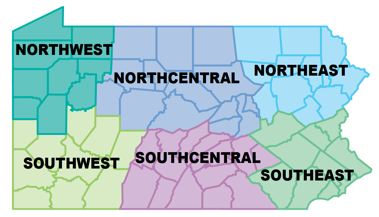
TROUT FISHING SOUTHEAST REGION
Southeast Region Regulated Trout Waters
Statewide Opening Day of Trout Season Stocked Trout Waters OPENING DAY: APRIL 6
BERKS:
- Antietam Creek (Antietam Reservoir to South St. Lawrence Borough Line at Exeter Park)
- Antietam Reservoir
- Furnace Creek (Robesonia Reservoir Dam to mouth)
- Hay Creek (White Bear Road bridge to mouth)
- Kistler Creek (junction Kistler Valley Road and Donats Peak to mouth)
- Little Lehigh Creek (Longswamp Road bridge to Smith Lane bridge)
- Little Swatara Creek (South Faust Road to Salem Road)
- Maiden Creek (Kistler Creek to dam in Lenhartsville)
- Manatawny Creek (SR 0073 bridge to 250 meters downstream confluence Furnace Run and Oley/Earl Township line to Airport Road bridge and 400 meters downstream Levengood Run to Ironstone Creek)
- Mill Creek (500 meters upstream Stump Road bridge to mouth)
- Mill Creek (Creamery Road bridge at Mill Road intersection to Hassler Run)
- Mill Creek (unnamed tributary downstream Millbach Road to unnamed tributary downstream Lebanon/Berks County Line)
- Northkill Creek (Feick Drive bridge to mouth)
- Ontelaunee Creek (unnamed tributary 225 meters upstream SR 4036 to mouth)
- Perkiomen Creek (Tollgate Road bridge, Berks County, to first unnamed tributary downstream Fruitville Road, Montgomery County)
- Pine Creek (unnamed tributary near Pine Creek Road/Hawk Mountain Road junction to mouth)
- Sacony Creek (Bowers Road to SR 222 bridge Kutztown)
- Scotts Run Lake
- Spring Creek (Sewer Treatment Plant 490 meters upstream SR 3010 to Blue Marsh)
- Swabia Creek (State Street Bridge, Berks County, to mouth)
- Tulpehocken Creek (450 meters upstream Richland Road to Charming Forge Road bridge)
- West Branch Conestoga River (approximately 350 meters upstream powerline to mouth)
- Willow Creek (unnamed tributary 1.5 kilometers upstream Schaeffer Road to SR 73)
- Wyomissing Creek (former mill dam upstream Mohnton Borough boundary to SR 222 bridge)
BUCKS:
- Delaware Canal (upstream boundary up Washington Crossing State Park to canal lock at lower Park boundary and upstream boundary Lower Washington Crossing State Park to Ferry Road bridge Morrisville)
- East Branch Perkiomen Creek (Branch Road bridge to Mill Creek)
- Levittown Lake
- Tohickon Creek (Dark Hollow Road bridge to mouth)
- Unami Creek (150 meters downstream T-477 Milford Square Park to Pennsylvania Turnpike)
CHESTER:
- Beaver Creek (SR 0030 to mouth)
- Big Elk Creek (confluence East and West Branch Elk Creek to Camp Bonsall Road bridge)
- Buck Run (Compass Road bridge to SR 372)
- East Branch Big Elk Creek (swale 400 meters upstream Oxford Road to West Branch Elk Creek)
- East Branch Brandywine Creek (SR 4031 to Reeds Road and Dowlin Forge to Pennsylvania Avenue in Downingtown)
- East Branch Octoraro Creek (Steelville Road bridge, Steeleville, to Knight Run)
- East Branch White Clay Creek (first unnamed tributary downstream SR 0001 to mouth)
- French Creek (upper State Game Lands #43 boundary off Harmonyville Road to 475 meters downstream Coventryville Road and 750 meters upstream
- Bertolet School Road to Hoffecker Road and unnamed tributary upstream West Seven Stars Road to SR 23 bridge)
- Middle Branch White Clay Creek (Guernsy Road to Good Hope Road)
- Pickering Creek (Pikeland Road bridge to Merlin Road bridge)
- Pocopson Creek (Red Lion Road to mouth)
- Valley Creek West (SR 100 to the confluence with the unnamed tributary, locally known as Colebrook Run)
- West Branch Brandywine Creek (SR 4005 Cedar Knoll downstream to SR 0340)
- White Clay Creek (confluence East and Middle Branch White Clay Creek to PA/DE Stateline)
DELAWARE:
- Chester Creek (dam upstream Forge Road to Bridgewater Road bridge)
- Darby Creek (804 meters upstream Little Darby Creek to Hilldale Road bridge)
- Ithan Creek (I-476 to mouth)
- Little Darby Creek (most upstream bridge in Willows Park to mouth)
- Ridley Creek (2,000 meters upstream SR 4008 to falls 225 meters upstream SR 4004 Barren and Bishop Hollow Roads and Brookhaven Road bridge to Chestnut Street bridge)
- West Branch Chester Creek (Railroad crossing upstream Ivy Mills Road to mouth)
LANCASTER:
- Big Beaver Creek (SR 222 and White Oak Road intersection to mouth)
- Bowery Run (Railroad overpass to mouth)
- Conowingo Creek (Black Bear Road to Black Baron Road)
- Conoy Creek (Saegerville Road bridge to mouth)
- East Branch Octoraro Creek (Steelville Road bridge, Steeleville, to Knight Run)
- Fishing Creek (Silver Spring Road bridge to mouth)
- Hammer Creek (Hammer Creek Road to SR 322 bridge and Speedwell Forge Lake to Brunnerville Road and Clay Road to mouth)
- Indian Run (Pleasant View Road to mouth)
- Little Beaver Creek (Calamus Run to Walnut Run Road)
- Little Chiques Creek (unnamed tributary 0.65 miles upstream Mountain Joy Road to SR 230)
- Little Cocalico Creek (unnamed tributary 250 meters upstream Southwest Creamery Road crossing to mouth)
- Little Conestoga Creek (powerline upstream Miller Road to Harrisburg Pike)
- Little Muddy Creek (Bowmansville Road to 140 meters downstream SR 897–Sewer Treatment Plant Discharge)
- Meetinghouse Creek (Haiti Road bridge to Nickel Mines Run)
- Middle Creek (Middle Creek Reservoir Dam to West Lime Rock Road)
- Muddy Creek (100 meters upstream Pleasant Valley Road bridge to SR 897 bridge, Fivepointville)
- Muddy Run (unnamed tributary upstream northern SR 772 crossing to powerline crossing)
- Pequea Creek (Wanner Drive bridge downstream to 100 meters downstream of School Lane Road)
- Rock Run (downstream boundary of campground 1.94 kilometers downstream Berks County to mouth)
- Stewart Run (St. Catherine Road to mouth)
- Swarr Run (Yellow Goose Road to SR 741)
- West Branch Little Conestoga Creek (Bender Mill Road to Owl Bridge Road)
- West Branch Octoraro Creek (Mount Pleasant Road bridge to Noble Road)
LEHIGH:
- Cedar Creek (Lake Muhlenburg to mouth)
- Coplay Creek (Dam upstream Hill Street bridge, Ormrod, to mouth)
- Jordan Creek (SR 309 to Ceder Crest Boulevard bridge and 0.3 kilometer upstream Mauch Chunk Road to mouth)
- Kistler Creek (junction Kistler Valley Road and Donats Peak to mouth)
- Laurel Run (Mill Road bridge to Coopersburg Discharge Sewer Treatment Plant)
- Lehigh Canal (first lock upstream Monocacy Creek crossing to Nancy Run crossing)
- Little Lehigh Creek (Longswamp Road bridge to Smith Lane bridge and Spring Creek to Wild Cherry Lane and 0.4 kilometer upstream Country Club Road bridge to upstream Face Fish Hatchery Road bridge and 155 meters upstream 24th Street Bogart's bridge to mouth)
- Monocacy Creek (Illicks Mill Dam to mouth)
- Ontelaunee Creek (Mosserville Road to Donats Peak Road and unnamed tributary 225 meters upstream SR 4036 to mouth)
- Swabia Creek (State Street bridge, Berks County, to mouth)
- Switzer Creek (junction Bachman Road and Bausch Road to mouth)
- Trout Creek (Furnace Road bridge, Lehigh Furnace, to mouth)
MONTGOMERY:
- Deep Creek Dam
- East Branch Perkiomen
- Creek (900 meters upstream Skip Sal Road to Bergeys Mill Road)
- Kepner Creek (Whitehall Road to mouth)
- Loch Alsh Reservoir Manatawny Creek (Route 100 to mouth)
- Pennypack Creek (Lorimer Park at old
- Railroad crossing/rail trail to Frankford Avenue)
- Perkiomen Creek (Tollgate Road bridge (Berks County) to first unnamed tributary downstream Fruitville Road (Montgomery County))
- Skippack Creek (Old Forty Foot Road to mouth)
- Stony Creek (Railroad crossing downstream Germantown Avenue to junction West Elm and Markley Street)
- Unami Creek (Whites Mill Road to SR 0063)
- Wissahickon Creek (from Lafayette Ave. to Stenton Ave.)
NORTHAMPTON:
- Bushkill Creek (Bushkill Center Road bridge Copella to Filetown Road bridge Belfast junction and private bridge off Bushkill Drive to 0.1 mile upstream of Edgewood Avenue bridge (former Binney-Smith Dam) and 13th Street bridge to mouth)
- Hokendauqua Creek (entrance bridge to Point Philips Rod & Gun Club to 0.38 miles downstream Church Road bridge and 220 meters upstream second upstream Kreidersville Road bridge
to mouth) - Indian Creek (0.44 miles downstream Cedar Drive bridge to Indian Trail Road bridge)
- Jacoby Creek (Sand Point Road bridge to mouth)
- Lehigh Canal (first lock upstream Monocacy Creek crossing to Nancy Run crossing and 1.0 kilometers downstream Carbon County Line to West Bertsch Creek)
- Little Bushkill Creek (Delabole Road bridge to Jones Hill Road bridge and unnamed tributary Engles Road bridge to mouth)
- Martins Creek (confluence East and West Branch Martins Creek to Bangor Sewer Treatment Plant discharge and Waltz Creek to dam 0.6 kilometers upstream intersection South Main Street and Old Franklin)
- Minsi Lake
- Monocacy Creek (SR 248 bridge to SR 512 bridge and 0.3 kilometers upstream Georgetown Road bridge to 100 meters downstream U.S. 22 bridge at PA19 and Illicks Mill Dam to mouth)
- Saucon Creek (second Railroad bridge upstream near Bingen to 0.38 miles upstream High Street bridge)
PHILADELPHIA:
- Pennypack Creek (Lorimer Park at old railroad crossing/rail trail to Frankford Avenue)
- Wissahickon Creek (Germantown Pike to Wises Mill Road junction)
SCHUYLKILL:
- Bear Creek (500 meters down-stream T-895/Bear Creek Road junction to a cable 800 yards above T-662)
- Deep Creek (Creek Road to mouth)
- Little Catawissa Creek (Reservoir Road to Trout Run Road)
- Little Mahanoy Creek (Malones Road bridge to Gordon Mountain Road bridge)
- Little Schuylkill River (Locust Creek to Panther
Stocked Trout Waters Open to Year-Round Fishing
BERKS:
- Kaercher Creek Dam
- Tulpehocken Creek (from covered bridge at T-921 downstream to the mouth)
BUCKS:
- Lake Luxembourg
LANCASTER:
- Muddy Run Recreation Lake
LEHIGH:
- Leaser Lake
SCHUYLKILL:
- Sweet Arrow Lake Tuscarora Lake
Catch and Release Artificial Lures Only
NORTHAMPTON:
- Bushkill Creek – 1.19 miles; from 0.1 mile upstream of Edgewood Avenue bridge (former Binney-Smith Dam) downstream to the 13th Street Bridge
Catch and Release All Tackle
CHESTER/MONTGOMERY:
- Valley Creek – at Valley Forge and tributaries including Little Valley Creek. Be aware that Valley Forge National Historic Park has imposed special bait restrictions. Check local posters.
Catch and Release Fly-Fishing Only
CHESTER:
- French Creek – 0.9 mile; from the dam at Camp Sleepy Hollow downstream to Hollow Road
DELAWARE:
- Ridley Creek – 0.6 mile; from the falls in Ridley Creek State Park downstream to the mouth of Dismal Run
LANCASTER:
- Donegal Creek – 2.21 miles; from 275 yards below SR 772 downstream to T-334
- West Branch Octoraro Creek – 2.0 miles; From 30 yards downstream of SR 0472 downstream to 230 yards upstream of the second unnamed tributary downstream of SR 2010 (Puseyville Road)
LEHIGH:
- Little Lehigh Creek – 1.54 miles; from the downstream face of the bridge on T-508 (Wild Cherry Lane) downstream to the upstream face of the bridge on T-510 (Millrace Road)
- Little Lehigh Creek – 0.83 mile; from the upstream face of Fish Hatchery Road bridge downstream to near the Oxford Drive bridge
Delayed Harvest Artificial Lures Only
BERKS:
- Tulpehocken Creek – 3.8 miles; from the first deflector below Blue Marsh Dam downstream to the T-921 covered bridge
CHESTER:
- East Branch Brandywine Creek – 1.2 miles; from SR 4019 (Dorlan’s Mill Road) downstream to SR 4004 (Dowlin Forge Road)
- Pickering Creek – 1.5 miles; from SR 1019 (Charlestown Road) downstream to 330 yards upstream of the railroad bridge Middle Branch White Clay Creek – 1.67 miles; from SR 3009 (Good Hope Road) downstream to the confluence with the East Branch
- West Valley Creek – 1.2 miles; from the confluence with the unnamed tributary (locally known as Colebrook Run) upstream of SR 2020 (Boot Road) downstream to 0.25 milesof the Railroad Tunnel
SCHUYLKILL:
- Bear Creek – 1.74 miles; from a cable 800 yards above T-662 downstream to the downstream side of the bridge on T-676
- Little Schuylkill River – 1.7 miles; from SR 895 in New Ringgold downstream to the T-848 bridge near Rauschs
Artificial Lures Only Trout Slot Limit
NORTHAMPTON:
- Monocacy Creek – 2.21 miles; from Illick’s Mill Dam upstream to and including the Gertrude Fox Conservation Area
- Saucon Creek – 2.10 miles; from the upstream boundary of the city of Bethlehem property downstream to the SR 0412 bridge.
Southcentral Region Regulated Trout Waters
Southcentral Region Regulated Trout Waters
ADAMS:
- Bermudian Creek (Cranberry Road bridge to Wireman's Mill Road bridge and Greenbriar Road bridge to SR 0094 bridge)
- Carbaugh Run (1.28 kilometers upstream Franklin/Adams to mouth)
- Conewago Creek (SR 234 bridge Arendtsville to Harrisburg Road)
- Conococheague Creek (former dam at Birch Run Reservoir to Boyers Mill Road bridge)
- East Branch Antietam Creek (Waynesboro Reservoir to Vineyard Run)
- Latimore Creek (Mountain Road to mouth)
- Little Marsh Creek (SR 3018 to Knoxlyn Road)
- Marsh Creek (Cashtown Road bridge to Route 30 bridge)
- Middle Creek (Strawberry Nature Preserve to McGlaughlin Road T-318)
- Opossum Creek (Wenksville Road to mouth)
- Orrtanna Pond
- Toms Creek (Mount Hope Road to SR 0116 bridge)
- Waynesboro Reservoir
BEDFORD:
- Beaver Creek (SR 1027 to mouth)
- Bobs Creek (Rhodes Run to mouth)
- Clear Creek (Black Valley Road bridge to Elk Lake Lick Road and first bridge on North Milk and Water Road to mouth)
- Cove Creek (Valley Road bridge to mouth)
- Evitts Creek (last downstream SR 220 bridge to Koon Lake)
- Gladdens Run (SR 2013 to mouth)
- Little Wills Creek (Wolf Camp Run to mouth)
- Maple Run (State Game Lands #73 boundary to mouth)
- Raystown Branch Juniata River (0.8 kilometers upstream SR 1013 to Shobers Run)
- Sherman Valley Run (Valley Church Road Building to mouth)
- Town Creek (Blues Gap Road bridge to 1.4 miles upstream PA/MD stateline)
- Wills Creek (0.5 kilometers upstream Mckenzie Road bridge to Railroad bridge 400 meters downstream Brush Creek)
- Yellow Creek (Beaver Creek to Red Bank Hill and SR 0026 bridge to mouth)
BLAIR:
- Bald Eagle Creek (California Hollow Run to mouth) Beaverdam Creek (Bedford/Blair County Line to mouth)
- Bells Gap Run (Bellwood Reservoir to mouth)
- Blair Gap Run (lower Blair Gap Muleshoe Reservoir to mouth)
- Canoe Creek (bridge 100 meters upstream powerline to mouth)
- Clover Creek (SR 2005 bridge at Henrietta to Larke Road bridge near Larke)
- Frankstown Branch Juniata River (Confluence Pine Run and Beaverdam Creek to Halter Creek)
- Poplar Run (first bridge on Poplar Run Road downstream (T-380) to mouth)
- Riggles Gap Run (Asbury Lane bridge (Riggles Gap) to mouth)
- South Poplar Run (Carson Run to mouth)
- Vanscoyoc Run (Decker Hollow Road to mouth)
CUMBERLAND:
- Big Spring Creek (Nealy Road bridge to Route 641 bridge)
- Doubling Gap Lake Fuller Lake
- Green Spring Creek (800 meters upstream Route 641 to 600 meters upstream Bullshead Road bridge)
- Laurel Lake
- Middle Spring Creek (Avon Road to mouth)
- Mountain Creek (Laurel Lake Dam outflow to 400 meters downstream campground entrance and Hunters Run to mouth)
- Yellow Breeches Creek (Route 233 bridge to mouth)
DAUPHIN:
- Armstrong Creek (Rutter Road to SR 0225)
- Clark Creek (T-684 to mouth) Mahantango Creek (Route 125 bridge to Kiwanis Farm Bridge Road)
- Manada Creek (Furnace Road to Orchard Road)
- Middletown Reservoir
- Pine Creek (Fountain Road to mouth)
- Powell Creek (confluence North and South Fork Powell Creek to Back Road bridge Waynesville and unnamed tributary near T-358 and T-553 intersection to Mountain Road bridge)
- Rattling Creek (Lykens Water Authority Reservoir to mouth)
- South Fork Powell Creek (Carsonville Road to mouth)
- Stony Creek (State Game Lands 211 gate to mouth)
- West Branch Rattling Creek (Lykens Road bridge to Lykens Water Authority cable crossing upstream of Powells Valley Road)
- Wiconisco Creek (SR 0225 bridge to mouth)
FRANKLIN:
- Buck Run (spring 100 meters upstream conrail crossing to mouth)
- Carbaugh Run (1.28 kilometers upstream Franklin/Adams to mouth)
- Conococheague Creek (former dam at Birch Run Reservoir to Boyers Mill Road bridge)
- Conodoguinet Creek (Bear Valley Run to Letterkenny Reservoir)
- Dennis Creek (McCord Road bridge to mouth)
- East Branch Antietam Creek (Waynesboro Reservoir to Vineyard Run and Village of Roadside to SR 0016 bridge)
- Falling Spring Branch (Fifth Avenue to mouth)
- Letterkenny Reservoir
- Little Cove Creek (3rd RT 456 bridge downstream SR 0456 to Mill Drive)
- Rowe Run (700 meters upstream Pinola Road to mouth)
- West Branch Antietam Creek (Nunnary Road bridge to mouth)
- West Branch Conococheague Creek (Amberson Road bridge to new U.S. 30 bridge at Fort Loudon)
FULTON:
- Big Cove Creek (SR 1003 bridge to Laurel Ridge Road)
- Cowans Gap Lake
- Laurel Fork (Cove Road to mouth)
- Licking Creek (SR 0522 bridge to Baby Run)
- Little Aughwick Creek (confluence North and South Branch Little Aughwick Creek to Huntingdon County Line)
- Little Brush Creek (Roaring Run to Little Brush Creek)
- Little Tonoloway Creek (Upper State Game Lands 128 boundary to SR 0655 bridge)
- North Branch Little Aughwick Creek (Pleasant Hill Road bridge to mouth)
- Oregon Creek (4.8 kilometers upstream mouth to mouth)
- Sideling Hill Creek (confluence of Oregon Creek and Laurel Fork to Trestle Hollow club boundary and Roaring Run to SR 4013 and SR 0913 at New Grenada)
- South Branch Little Aughwick Creek (spring upstream Richmond spring to mouth)
- Spring Run (Union Church Road to mouth )
- Wooden Bridge Creek (North Hess Road bridge to Wooden bridge #2 Road)
HUNTINGDON:
- Blacklog Creek (Farm Lane Bridge at Byron Church to mouth)
- Globe Run (150 meters downstream lake to mouth)
- Great Trough Creek (Newburg Park Road bridge (T-370) to 200 yards downstream State Park swimming area)
- Greenwood Lake
- Laurel Run (Owl Gap Trail to mouth)
- North Branch Little Aughwick Creek (Pleasant Hill Road bridge to mouth)
- North Spring Branch (Route 829 bridge to 200 meters downstream Route 944 bridge)
- Saddler Creek (SR 1007 bridge to mouth)
- Shade Creek (unnamed tributary upstream Felix Run to mouth)
- Shaver Creek (Stone Valley Lake to SR 0305 bridge at Bethel Church)
- Standing Stone Creek (Penn Roosevelt Dam to first
- SR 0026 bridge north of Huntingdon)
- Three Springs Creek (confluence North Spring Branch and Spring Creek to mouth)
- Tuscarora Creek (old Route 2009 bridge Nossville to Horse Valley Run)
- West Licking Creek (2.13 kilometers upstream Mountain Union Water Reservoir to mouth)
- Whipple Lake
JUNIATA:
- Big Run (Arch Rock Road bridge to mouth)
- Blacklog Creek (Farm Lane bridge at Byron Church to mouth)
- Cocolamus Creek (SR 2013 bridge to Cranes Run) Delaware Creek (first Route 333 bridge downstream East Salem to mouth)
- East Licking Creek (Wynn Gap Road bridge to mouth)
- Horning Run (Spigelmyer Run to mouth)
- Horse Valley Run (upper Tuscarora State Forest boundary to mouth)
- Laurel Run (Little Valley Creek to mouth)
- Lost Creek (Route 35 bridge upstream Little Lost Creek to mouth)
- Tuscarora Creek (old Route 2009 bridge Nossville to Horse Valley Run)
- West Branch Mahantango Creek (Crater Hill Road to Creek Road and Stream Ford)
LEBANON:
- Bachman Run (SR 0322 to mouth)
- Conewago Creek (first SR 241 bridge Northeast of Lawn to Little Conewago Creek)
- Hammer Creek (Hammer Creek Road to SR 322 bridge)
- Indiantown Run (Joseph Springs Hatchery to Marquette Lake)
- Lions Lake Marquette Lake
- Mill Creek (unnamed tributary downstream Millbach Road to unnamed tributary downstream Lebanon/ Berks County Line)
- Quittapahilla Creek (Snitz Creek to Annville Sewer Treatment Plant and Clear Spring Road bridge to mouth)
- Snitz Creek (Zinns Mills to mouth)
- Stovers Lake
- Trout Run (Upper Ridge Road to mouth)
- Tulpehocken Creek (Creamery Street bridge to 100 meters downstream from unnamed tributary downstream of T-618 bridge)
MIFFLIN:
- East Licking Creek (Wynn Gap Road bridge to mouth)
- Havice Creek (intersection Havice Valley Road and Flat Hollow Road to Locke Mills Road bridge (Siglerville))
- Honey Creek (Upper Bald Eagle State Forest boundary to 0.91 kilometers downstream to 0.5 miles downstream Treaster Run)
- Kishacoquillas Creek (Bunker Road bridge to Taylor Mill Road and 1.5 miles upstream confluence Tea Creek to Penn Central Railroad bridge and Mill Streetbridge to mouth)
- Lingle Creek (625 meters upstream Conklin Road Bridge to mouth)
- Meadow Creek (Drivey Valley Road bridge to mouth)
- Strodes Run (Valley Road bridge to 500 meters downstream Strodes Run Road bridge)
- Treaster Run (Treaster Valley Road bridge to lower Bald Eagle State Forest boundary)
- West Licking Creek (2.13 kilometers upstream Mountain Union Water Reservoir to mouth)
PERRY:
- Bixler Run (SR 850 bridge (Kistler) to SR 850/274 bridge (Fort Robinson))
- Buffalo Creek (Heritage Hills Road bridge to Route 849 bridge downstream to Walnut Grove)
- Bull Run (Historic Community Christian Church to mouth)
- Fishing Creek (Trout Run to SR 11/15)
- Fowler Hollow Run (where Fowler Hollow Road leaves Creek to mouth)
- Horse Valley Run (upper Tuscarora State Forest boundary to mouth)
- Laurel Run (Little Valley Creek to mouth)
- Little Buffalo Creek (Mannsville Road bridge to mouth)
- Little Juniata Creek (Roth Road to Linton Hill Road)
- McCabe Run (Trout Run to mouth)
- Montour Creek (SR 274 to mouth)
- Panther Creek (Route 17 bridge (Ickesburg) to mouth)
- Raccoon Creek (Route 17 bridge upstream Donnally Mills to mouth)
- Sherman Creek (lower Tuscarora State Forest boundary to Couchtown Road bridge (Cisna Run))
- Shultz Creek (Fowler Hollow Run to mouth)
YORK:
- Bald Eagle Creek (Garvine Mill Road to 250 meters downstrream Gamble Road)
- Beaver Creek (Burkholder Road to mouth) Codorus Creek (Tannary
- Road to West Branch Codorus Creek)
- Deer Creek (Five Forks Road bridge (junction T-540 and T-542) to first unnamed tributary downstream Stewartstown Road)
- East Branch Codorus Creek (first unnamed tributary downstream South boundary city park to Iron Stone Hill Road bridge)
- Fishing Creek (Red Mill Road to SR 0262)
- Fishing Creek (Snyder Corner Road to 500 meters upstream mouth)
- Muddy Creek (confluence North and South Branch Muddy Creek to private Road on north bank and 300 yards upstream of Bridgeton Road (SR 2032) bridge in Bridgeton to powerline crossing 2.6 kilometers downstream PA 425)
- North Branch Muddy Creek (Pine Run to Carter Creek and Laurel Road bridge to mouth)
- Otter Creek (Hake Road bridge to mouth)
- South Branch Codorus Creek (AUD prop 700 meters upstream T-537 bridge to 350 meters downstream Shaffers Church Road)
- South Branch Muddy Creek (Alum Rock Run to 430 meters upstream confluence unnamed tributary East T-633 and T-634)
- Yellow Breeches Creek (RT 233 bridge to mouth)
Stocked Trout Waters Open to Year-Round Fishing
BEDFORD:
- Koon Lake
BLAIR:
- Canoe Creek Lake
CUMBERLAND:
- Mountain Creek (from Adams County line downstream to the backwaters of Laurel Lake)
- Opossum Lake
DAUPHIN/LEBANON:
- Stony Creek (from .4-mile upstream of Cold Spring Road downstream to State Game Lands #211 gate)
HUNTINGDON:
- Lake Perez
LEBANON:
- Lakeside Quarry
PERRY:
- Little Buffalo Lake (Holman Lake)
YORK:
- South Branch Codorus Creek (from SR 0616 in Centerville downstream to T-527)
Catch and Release Artificial Lures Only
CUMBERLAND:
- Yellow Breeches Creek – 1.17 miles; 0.17 miles of the Unnamed Tributary to Yellow Breeches Creek (from the outfall of Children’s Lake to the confluence with Yellow Breeches Creek at Boiling Springs) and 1.0 mile of Yellow Breeches Creek from the confluence with the Unnamed Tributary at Boiling Springs downstream to the vicinity of Allenberry
HUNTINGDON:
- Spruce Creek – 0.5 mile; Penn State Experimental Fisheries Area (about 0.6 mile above the village of Spruce Creek)
- Spruce Creek – 0.15 mile; PFBC property at Indian Caverns near Franklinsville
MIFFLIN/UNION:
- Penns Creek – 7.45 miles; from approximately 600 meters downstream of Swift Run downstream to the downstream extent of the island near the end of Jolly Grove Lane
Catch and Release All Tackle
BLAIR/HUNTINGDON:
- Little Juniata River – 13.7 miles from the railroad bridge at the east (downstream) border of Ironville downstream to mouth
Catch and Release Fly-Fishing Only
ADAMS:
- Conewago Creek – 1.1 miles; from 0.1 mile downstream of T-340 (Russel Tavern Rd.) downstream to SR 34
BEDFORD:
- Yellow Creek – 0.9 mile from mouth of Maple Run (Jacks Run) upstream to cable near Red Bank Hill
CUMBERLAND:
- Big Spring Creek – 1.52 miles; from 100 feet below the source (Big Spring) downstream to the Nealy Road bridge
- Green Spring Creek – 1.2 mile; from mouth upstream to near confluence with Bulls Head Branch
- Letort Spring Run – 1.7 miles; from 300 yards upstream of bridge on T-481 (Bonnybrook Road) downstream to the Reading Railroad bridge at the southern edge of Letort Spring Park
DAUPHIN:
- Clark Creek –2.4 miles; PGC rifle range parking area on SR 325 downstream to PGC access road at the Iron Furnace
FRANKLIN:
- East Branch Antietam Creek – 0.88 mile; from SR 16 downstream to T-365 (Welty Rd.)
- Falling Spring Branch – 2.5 miles; from the first private lane located 672 feet upstream of Briar Lane bridge downstream to a wire fence crossing the Thomas L. Geisel property
YORK:
- Muddy Creek – 1.6 miles; from 300 yards downstream of Bruce Road bridge (T-628) in Bruce downstream to 300 yards upstream of Bridgeton Road (SR 2032) bridge inBridgeton
Delayed Harvest Artificial Lures Only
DAUPHIN:
- Manada Creek – 1.8 miles; from Fogarty Road downstream to Furnace Road (T-616)
- Wiconisco Creek – 0.74 mile: from the western edge of the Ned Smith Center for Nature and Art walking bridge downstream to the power line crossing located 1.7 miles upstream from the mouth
FRANKLIN:
- Falling Spring Branch – 1.02 miles; from Walker Road downstream to Fifth Avenue
FULTON:
- Big Cove Creek – 0.93 mile; from 200 yards downstream of the SR 0928 bridge downstream to the lower Buchanan State Forest boundary
JUNIATA/MIFFLIN:
- East Licking Creek – 4.0 miles; from the Texas Eastern gas pipeline crossing downstream to the upstream boundary of the Karl B. Guss State Forest Picnic Area
LEBANON:
- Quittapahilla Creek – 1.1 miles; from Spruce Street bridge on T-398 downstream to the SR 0934 bridge
MIFFLIN:
- Honey Creek – 1.75 miles; from the upper Bald Eagle State Forest boundary downstream 1.75 miles
Artificial Lures Only Trout Slot Limit
YORK:
- Codorus Creek – 2.00 miles; from the West Branch Codoru Creek downstream to 0.40 miles downstream from Thomas Drive
Southwest Region Regulated Trout Waters
Statewide Opening Day of Trout Season Stocked Trout Waters OPENING DAY: APRIL 1
ALLEGHENY:
- Big Sewickley Creek (confluence Big and East Branch Sewickley Creek to SR 4036 bridge)
- Bull Creek (Stone Quarry Road bridge to mouth)
- Deer Creek (300 meters upstream West Branch Deer Creek to big bend 0.9 kilometers downstream T-662 bridge)
- Flaugherty Run (Boggs Run to mouth)
- Long Run (Jacks Run to upper boundary Versailles Borough)
- Lower Deer Lake Middle Deer Lake
- Pine Creek (North Park Lake Dam to 375 meters upstream Montour Run and Willow Run to abandoned railroad bridge near the T-575 and Duncan Ave. intersection and SR 0008 bridge Allison Park to 100 meters upstream Railroad bridge)
- Turtle Creek (Saunders Station bridge to Brush Creek)
- West Deer Lake (Upper Deer Lake)
ARMSTRONG:
- Buffalo Creek (upstream end of Mun Park in Chicora to 2.4 kilometers downstream SR 3004 bridge)
- Cherry Run (SR 2005 bridge to mouth)
- Cornplanter Run (T-658 bridge to mouth)
- Cowanshannock Creek (Huskins Run to mouth)
- Glade Run (Lemmon Hollow Road bridge to second tributary 625 miles downstream Pony Fork Road bridge)
- Huling Run (fourth tributary upstream mouth to 2nd T-440 bridge)
- Little Sandy Creek (SR 0236 bridge to mouth)
- North Fork Pine Creek (Route 66 bridge to mouth)
- Patterson Creek (due east of junction T-557 and SR 4007 to mouth)
- Plum Creek (headwaters to mouth)
- Redbank Creek (North Fork Redbank Creek to Little Sandy Creek)
- Scrubgrass Creek (Muskrat Slide Road bridge to Pine Township Line)
- South Fork Pine Creek (headwaters to mouth)
BEAVER:
- Big Sewickley Creek (confluence Big and East Branch Sewickley Creek to SR 4036 bridge)
- Brush Creek Park Pond
- Mill Creek (Hookstown to last bridge crossing Georgetown Road)
- North Fork Big Sewickley Creek (3.2 kilometers upstream mouth to mouth)
- North Fork Little Beaver Creek (Mud Road bridge to SR 551 bridge)
- South Branch Brady Run (May Road bridge to Brady Run)
- Traverse Creek (Raccoon Lake to mouth)
CAMBRIA:
- Beaverdam Run (SR 1011 to mouth)
- Bens Creek (Portage Water Authority Dam to 0.9 kilometers downstream SR 2012 bridge)
- Chest Creek (confluence unnamed tributary Bradley junction to mouth)
- Clearfield Creek (Beaverdam Run to Kolak Road)
- Duman Lake
- Elton Sportsmens Dam Hinckston Run (500 meters upstream T-419 bridge to Hinckston Run Reservoir)
- Howells Run (first SR 2013 bridge downstream Ebensburg to mouth)
- Killbuck Run (Little Killbuck Run to mouth)
- Lake Rowena
- Laurel Lick Run (Veterans Dam to mouth)
- Laurel Run (Lecks Road bridge to mouth)
- Laurel Run (1.2 kilometers upstream Red Run to mouth)
- Little Paint Creek (Elton Sportsmen Club Dam to T-305 bridge)
- Noels Creek (T-433 bridge to mouth)
- North Branch Blacklick Creek (SR 0271 bridge (Blue Goose) to Elk Creek)
- North Branch Little Conemaugh River (Wilmore Dam to SR 0160 bridge)
- Stewart Run (400 meters upstream US22 bridge to mouth)
FAYETTE:
- Back Creek (Trout Run to mouth)
- Big Sandy Creek (Chaney Run to 350 meters downstream Stony Fork)
- Chaney Run (Headwaters to 200 meters downstream third SR 2003 downstream Wharton)
- Dunbar Creek (stone quarry along SR 1055 to Sheepskin Trail crossing downstream of ballfield)
- Dunlap Creek (SR 0166 bridge and T-933 intersection to T-326 bridge (Simpson Station))
- Georges Creek (from mouth of York Run to 119 bridge)
- Indian Creek (T-916 bridge to Champion Creek)
- Meadow Run (200 meters upstream SR 2015 bridge to 240 meters downstream SR 0381 bridge and Beaver Creek to bridge on Dinner Bell Road)
- Mill Run (Clay Run to mouth)
- Mountain Creek (Route 857 bridge to mouth)
- Virgin Run Lake
GREENE:
- Browns Creek (Garners Run to mouth)
- Dunkard Fork (North and South Fork Dunkard Fork to first SR 4003 bridge (Durbin))
- Enlow Fork (SR 4016 bridge to SR 4018 bridge downstream of T-324 bridge)
- Lake Wilma
- North Fork Dunkard Fork (Chess Hill Road bridge to mouth)
- South Fork Dunkard Fork (SR 3016 at Smith bridge to mouth)
- Whiteley Creek (I-79 to SR 2011 bridge)
INDIANA:
- Blacklegs Creek (0.3 miles upstream Shrokman Road (T-336)/Blacklegs Road (SR 3027) to Big Run)
- Brush Creek (T-734 bridge to mouth)
- Canoe Creek (Painter Run to mouth)
- Cush Creek (Horton Run to mouth)
- Cush Cushion Creek (Hemlock Road to mouth)
- Laurel Run (first tributary downstream T-868 to mouth)
- Little Mahoning Creek (Buterbaugh Road bridge to 700 meters downstream West and North Mahoning Township lines)
- Little Yellow Creek (T-631 bridge to Yellow Creek Lake)
- Mudlick Run (SR 4024 bridge to mouth)
- South Branch Two Lick Creek (SR 1019 bridge to SR 1014 bridge (old T-585))
- Toms Run (Pine Ridge County Park (State Game Lands #276 boundary) to mouth)
- Yellow Creek(300 meters upstream Diehl Road bridge to Yellow Creek Lake Route 422 bridge and unnamed tributary East White/Cherryhill Township line toRoute 954 bridge)
SOMERSET:
- Allen Creek (2.3 miles upstream mouth to mouth)
- Beaverdam Creek (Somerset/ Quemahoning Township line to T-647 bridge)
- Beaverdam Run (1.1 kilometers downstream SR 1018 bridge to mouth)
- Bens Creek (confluence North and South Fork Bens Creek to mouth)
- Breastwork Run (SR 1017 to mouth)
- Brush Creek (School House Road bridge to mouth) Casselman River (from PA - MD state line to Coal Run) Clear Shade Creek (Pine Lake to mouth)
- Cub Run (2.6 kilometers upstream mouth to mouth)
- Elklick Creek (Cranberry Run to SR 2004/T-510 intersection) Flaugherty Creek (West
- Myersdale Railroad bridge 0.8 miles upstream T-712 to SR 2006 bridge/T-566 intersection)
- Gladdens Run (SR 2013 to mouth)
- Glade Run (High Point Lake to mouth)
- Jones Mill Run (first bridge downstream Becks Spring to Laurel Hill Lake)
- Kimberly Run (362 meters upstream U.S. 219 upper bridge to mouth)
- Kooser Lake
- Kooser Run (upstream boundary Kooser State Park to mouth)
- Laurel Hill Creek (Clear Run to mouth)
- Little Piney Creek (Elk Lick Rod and Gun Club Dam to Piney Creek)
- McClintock Run (Glade Run to mouth)
- Middle Creek (SR 3029 bridge to mouth)
- Miller Run (Headwaters to mouth)
- Piney Creek (third PA-MD state line crossing to Greenville Road bridge and 0.8 miles upstream Engles Mill Road bridge to mouth)
- Piney Run (T-816 bridge to mouth)
- Raystown Branch Juniata River (0.8 kilometers upstream SR 1013 to Shobers Run)
- Shafer Run (400 meters downstream Shafer Run Trout Hatch to mouth)
- Shaffers Run (upstream SR 2021 bridge to mouth)
- South Fork Bens Creek (unnamed tributary 200 meters downstream SR 0985 bridge to 30 meters downstream private bridge off T-590 and Keafer Hill Road to mouth)
- Stonycreek River (T-515 bridge to T-565 bridge)
- Tub Mill Run (LR 55047 bridge Compton to mouth)
- Whites Creek (first Whites Creek Road bridge upstream Enos Run to mouth)
- Wills Creek (0.5 kilometers upstream Mckenzie Road bridge to Railroad bridge 400 meters downstream Brush Creek
WASHINGTON:
- Aunt Clara Fork (SR 4003 bridge to mouth)
- Dutch Fork (Dutch Fork Lake to mouth)
- Dutch Fork Lake
- Enlow Fork (SR 4016 bridge to SR 4018 bridge downstream of T-324 bridge)
- Kings Creek (T-853 bridge to Aunt Clara Fork)
- Little Chartiers Creek (PA 519 bridge to first SR 1023 bridge downstream Linden)
- Millers Run (T-608 bridge to bridge at Route 50 and LR 02339)
- Mingo Creek (1059 bridge at upstream park boundary to downstream boundary Mingo Creek Park)
- Pike Run (T-948 bridge to mouth)
- Templeton Fork (Rocky Run to mouth)
- Tenmile Creek (SR 0221 bridge at T-633 intersection to Bane Creek)
WESTMORELAND:
- Donegal Lake
- Fourmile Run (T-413 bridge to mouth)
- Hannas Run (Baton Road to mouth)
- Hendricks Creek (SR 0711 bridge to mouth)
- Indian Creek (SR 0381 bridge to Champion Creek)
- Indian Lake
- Jacobs Creek (Pennsylvania Turnpike bridge to Bridgeport Reservoir)
- Linn Run (unnamed tributary 500 meters upstream Grove Run Spring to lower State Park boundary)
- Loyalhanna Creek (Zimmerman Run to Monastery Run)
- Mammoth Lake
- Mill Creek (170 meters upstream Mill Road bridge to mouth)
- Sewickley Creek (T-565 bridge to Brinker Run)
- Shannon Run (Wildcat Road upper bridge to mouth) Tubmill Creek (Tubmill Reservoir to private lane connected to T470 (Keiper Rd))
- Turtle Creek (Saunders Station bridge to Brush Creek)
Stocked Trout Waters Open to Year-Round Fishing
ALLEGHENY:
- North Park Lake
ARMSTRONG:
- Mahoning Creek (Mahoning Creek Dam outflow downstream to the confluence of Pine Run)
BEAVER:
- Bradys Run Lake
- Main Lake (Raccoon Lake)
FAYETTE:
- Dunlap Creek Lake
FAYETTE/SOMERSET:
- Youghiogheny River (from the lake downstream to the confluence of the Casselman River)
INDIANA:
- Cummings Reservoir (Blue Spruce Lake)
SOMERSET:
- Blue Hole Creek (from confluence with Garys Run downstream to mouth)
- Fall Creek (from confluence with Ansell Run downstream to mouth)
- Laurel Hill Lake
WASHINGTON:
- Canonsburg Lake
WESTMORELAND:
- Keystone Lake Northmoreland Lake Twin Lakes Number One
- Reservoir (Lower Twin Lake) Twin Lakes Number Two
- Reservoir (Upper Twin Lake
Catch and Release Fly-Fishing Only
FAYETTE:
- Dunbar Creek – 4.22 miles; from the confluence of Glade Run downstream to the stone quarry along SR 1055
INDIANA:
- Little Mahoning Creek – 3.6 miles; from Oberlin Road bridge abutments upstream of SR 1041 bridge upstream to Cesna Run
SOMERSET:
- Clear Shade Creek – 1 mile; from the cable at Windber Water Dam upstream
Catch and Release All Tackle
CAMBRIA/INDIANA:
- West Branch Susquehanna River – 26.1 miles; (from outflow of AMD treatment plant near Watkins downstream to confluence of Cush Creek near Dowler Junction)
All Tackle Trophy Trout
FAYETTE/SOMERSET:
- Youghiogheny River – 9.16 miles; from the confluence with Ramcat Run downstream to the Route 381 bridge at Ohiopyle
Delayed Harvest Artificial Lures Only
ALLEGHENY:
- Deer Creek – 1.9 miles; from the SR 0910 bridge at T-678 intersection downstream to the lower boundary of Rose Ridge Golf Course
- Pine Creek – 1.4 miles; from the abandoned railroad bridge near the T-575 and Duncan Ave. intersection downstream to 150 yards downstream of the SR 4019 bridge
- Bull Creek – 1.0 mile; from the first bridge on T-721 (above the T-721 and T-719 intersection) downstream to the T-721 bridge in Millerstown
ARMSTRONG/BUTLER:
- Buffalo Creek– 3.7 miles; from Little Buffalo Run downstream to 0.6 mile above SR 4035 in Craigsville
CAMBRIA:
- Chest Creek – 2.5 miles; Ridge Avenue downstream to Thomas Mills Road
FAYETTE:
- Meadow Run – 2.2 miles; from the SR 2011 bridge (Dinner Bell Road) adjacent to the Ohiopyle St. Park office downstream to mouth
SOMERSET:
- Laurel Hill Creek – 2.33 miles; from 200 yards downstream of the T-364 (Countryman bridge) downstream to the T-364 bridge upstream of Laurel Hill Lake
- Laurel Hill Creek – 1.26 miles; from the footbridge on State Game Lands #111 Road in Humbert downstream to Paddytown Hollow Run
WASHINGTON:
- Dutch Fork – 1.59 miles; from the first bridge (SR 0070) upstream of the Columbia Gas Compressor Station downstream to the Dutch Fork Lake backwaters at T-487 bridge just off SR 3001 (Lake Road)
- Pike Run – 1.1 miles; from the confluence with the unnamed tributary upstream of the SR 2079 bridge downstream to the powerline crossing downstream of the SR 2036 bridge
WESTMORELAND:
- Indian Creek – 1.6 miles; from the T-916 bridge downstream to the SR 0381 bridge.
- Loyalhanna Creek – 1.67 miles; from SR 711 downstream to SR 2045 (Two Mile Run Road)
Northwest Region Regulated Trout Waters
Statewide Opening Day of Trout Season Stocked Trout Waters OPENING DAY: APRIL 1
BUTLER:
- Bear Creek (T-712 upstream Troutman to first bridge upstream Bruin)
- Bonnie Brook (Bonnie Brook Road to mouth)
- Buffalo Creek (upstream end of Mun Park in Chicora to 2.4 kilometers downstream SR 228 bridge)
- Connoquenessing Creek (Lake Oneida to SR 0356 bridge)
- Cornplanter Run (T-658 bridge to mouth)
- Glade Run Lake Harbar Acres Lake
- Little Buffalo Run (Clearfield Road bridge to mouth)
- Little Connoquenessing Creek (SR 0422 bridge to SR 3029 bridge)
- North Branch Slippery Rock Creek (White Oak Road bridge to mouth)
- Silver Creek (T-633 bridge to mouth)
- Slippery Rock Creek (0.75 miles downstream Slippery Rock Road to Heinz Camp property)
- Thorn Creek (Great Belt Road bridge to McCalmont Road bridge)
CLARION:
- Beaver Creek (T-384 bridge to Route 338 bridge (Blair's Corner))
- Canoe Creek (I-80 bridge to mouth)
- Cathers Run (220 meters upstream Cathers Run Road to mouth)
- Coon Creek (Zipp Run to Irish Run)
- East Sandy Creek (T-586 bridge to Clarion/Venango County Line)
- Leatherwood Creek (T-478 bridge to Pump Station (St. Charles))
- Mill Creek (T-342 bridge to Little Mill Creek)
- Piney Creek (SR 2001 bridge to Little Piney Creek)
- Redbank Creek (North Fork Redbank Creek to Little Sandy Creek)
- Richey Run (Route 208 bridge upstream T-550 to Allegheny River Trail bridge near mouth)
- Toms Run (T-627 bridge to childrens area near mouth)
- Turkey Run (Salem Road bridge to SR 0058 bridge (Alum Rock))
CRAWFORD:
- Caldwell Creek (West Branch Caldwell Creek to mouth)
- Conneaut Creek (Dicksonburg Road bridge (Dicksonburg) to Pennside Road)
- East Branch Oil Creek (Clear Lake Dam to mouth)
- Fivemile Creek (T-922 bridge to mouth)
- Little Sugar Creek (SR 2009 bridge to mouth)
- McLaughlin Creek (T-890 bridge to mouth)
- Muddy Creek (Dewey Road bridge to Teepleville Road bridge)
- North Deer Creek (Headwaters to mouth)
- Oil Creek (Mosey Run to SR 8 bridge at Rynd Farm)
- Pine Creek (Seldom Seen Road bridge to mouth)
- Sugar Creek (Center Road bridge to Wright Road bridge)
- Thompson Creek (100 meters upstream bridge SR 2031 to mouth)
- Woodcock Creek (SR 2036 bridge to mouth)
ERIE:
- Cascade Creek (12th Street bridge to mouth)
- Conneauttee Creek (Edinboro Lake to Route 99)
- Crooked Creek (Gloskey Road bridge to Railroad bridge North SR 5)
- East Basin Pond (Waterworks Ponds, Presque Isle State Park)
- Elk Creek (200 meters upstream I-79 NB bridge
- to 500 meters downstream SR 98 bridge and 500 meters upstream Halls Run to mouth)
- French Creek (PA-NY line to West Branch French Creek)
- Lake Pleasant
- South Branch French Creek (SR 2018 bridge (Corry Limits) to mouth)
- Twentymile Creek (SR 20 bridge to Dohler Property Line)
- Upper Gravel Pit West Basin Pond (Waterworks Ponds, Presque Isle State Park)
FOREST:
- Beaver Run (50 meters upstream Lick Run to mouth)
- Bluejay Creek (first SR 1003 bridge downstream SR 0066 to mouth)
- Coon Creek (Zipp Run to Irish Run)
- East Hickory Creek (Allegheny National Forest Road 119 bridge to mouth)
- Little Hickory Run (Furnace Run to mouth)
- Maple Creek (T-323 bridge to mouth)
- Queen Creek (Beers Hollow to mouth)
- Ross Run (unnamed tributary 1 kilometer upstream East Branch Ross Run to Ross Run Road bridge)
- Salmon Creek (Bluejay Road bridge to mouth)
- South Branch Tionesta Creek (800 meters upstream Fork Run to mouth)
- Spring Creek (East Branch Spring Creek to mouth)
- The Branch (Coal Bed Run to mouth)
- Tionesta Creek (South Branch Tionesta Creek to Kellettville bridge)
- Toms Run (T-627 bridge to childrens area near mouth
- West Branch Millstone Creek (Scott Run to SR 2005 bridge)
- West Hickory Creek (Youngsville Road bridge to mouth)
LAWRENCE:
- Bessemer Lake
- Big Run (SR 388 bridge to mouth)
- Deer Creek (1,500 feet upstream Route 208 bridge to mouth)
- Hickory Run (T-312 bridge to mouth)
- Honey Creek (0.25 miles upstream Musser Road bridge to North Fork Little Beaver Creek)
- Little Neshannock Creek (West Branch Little Neshannock Creek to mouth)
- Neshannock Creek (Headwaters to I-80 bridge and Cannery Road bridge to mouth)
- North Fork Little Beaver Creek (Mud Road bridge to Dinor Street bridge)
- Slippery Rock Creek (0.75 miles downstream Slippery Rock Road to Heinz Camp property)
- Taylor Run (1 mile upstream SR 1018 bridge to Slippery Rock Creek)
MERCER:
- Buhl Lake
- Cool Spring Creek (Lake Latonka to mouth)
- Little Neshannock Creek (West Branch Little Neshannock Creek to mouth)
- Little Shenango River (Lake Wilhelm Road bridge to mouth)
- Mill Creek (Scrubgrass Road bridge to mouth)
- Neshannock Creek (Headwaters to mouth)
- North Deer Creek (Headwaters to mouth)
- Pine Run (Crill Road bridge to Neshannock Creek)
- Sandy Creek (SR 173 bridge to SR 3013 bridge Pecan)
- West Branch Little Neshannock Creek (Bend Road to mouth)
- Wolf Creek (East Pine Street (Grove City) to 300 feet downstream Airport Road bridge)
VENANGO:
- East Branch Sugar Creek (SR 0428 to mouth)
- East Sandy Creek (Tarklin Run to mouth)
- Hemlock Creek (Porcupine Run to mouth)
- Horse Creek (250 meters upstream Wolf Branch to mouth)
- Little Sandy Creek (400 meters upstream Bombishi Road bridge to old bridge at Polk Center Pump House)
- Little Scrubgrass Creek (South Fork Little Scrubgrass Creek to mouth)
- Little Sugar Creek (SR 0027 bridge (Diamond) to mouth)
- Lower Twomile Run (Isaac Walton Park to mouth)
- Mill Creek (SR 0038 bridge to T-522 bridge)
- Oil Creek (Mosey Run to SR 0008 bridge at Rynd Farm)
- Pine Run (SR 0038 bridge to Bear Run)
- Pithole Creek (SR 0036 to 300 meters downstream SR 1004 Stone Arch bridge)
- Prather Creek (T-508 bridge to mouth)
- Richey Run (RT208 bridge upstream T-550 to Allegheny River Trail bridge near mouth)
- Sandy Creek (SR 0173 bridge to SR 3013 bridge in Pecan
- Sugar Creek (Center Road bridge to Wright Road bridge and 300 meters upstream Creek Road bridge to mouth)
- Twomile Run (Reed Run to mouth)
- West Pithole Creek (Coe Road bridge to mouth)
WARREN:
- Blue Eye Run (Eldred Hill Road bridge to State Game Lands boundary)
- Brokenstraw Creek (SR 3010 bridge to 2.6 kilometers upstream SR 0027 bridge Garland and 100 meters upstream SR 3010 bridge to Matthews Run)
- Browns Run (Hook Run to mouth)
- Caldwell Creek (West Branch Caldwell Creek to mouth)
- Chapman Lake
- East Branch Spring Creek (SR 3001 to mouth)
- East Branch Tionesta Creek (T-300 bridge downstream Jojo to mouth)
- East Hickory Creek (Allegheny National Forest Road 119 bridge to mouth)
- Farnsworth Branch (bridge at Farnsworth Coop Hatch to mouth)
- Fourmile Run (North Branch Fourmile Run to mouth)
- Hemlock Run (100 meters upstream Logging Road to mouth)
- Jackson Run (SR 0027 bridge to mouth)
- Little Brokenstraw Creek (SR 0957 bridge (Lottsville) to T-441 bridge (Pittsfield))
- Perry Magee Run (Youngsville Road to mouth)
- Pine Creek (Seldom Seen Road bridge to mouth)
- Queen Creek (Beers Hollow to mouth)
- Sixmile Run (North Fork Sixmile Creek to mouth)
- South Branch Tionesta Creek (800 meters upstream Fork Run to mouth)
- Spring Creek (East Branch Spring Creek to SR 3001 bridge)
- Thompson Run (800 meters upstream Double Run to mouth)
- Tidioute Creek (SR 3011 bridge to mouth)
- Tionesta Creek (South Branch Tionesta Creek to Kellettville bridge)
- Twomile Run (headwaters to mouth)
- West Branch Caldwell Creek (unnamed tributary West of Sanford to Three Bridge Run)
- West Branch Tionesta Creek (Jones Run to Wildcat Run and Chapman Dam to mouth)
- West Hickory Creek (Youngsville Road bridge to mouth)
Stocked Trout Waters Open to Year-Round Fishing
FOREST:
- Tionesta Creek (from Tionesta Dam outflow to mouth)
LAWRENCE:
- Cascade Quarry
MERCER:
- Shenango River (Hamburg Road bridge in New Hamburg to pipeline crossing upstream of Big Bend access area)
VENANGO:
- Two Mile Run Reservoir (Justus Lake)
Catch and Release Artificial Lures Only
WARREN:
- West Branch Caldwell Creek – 2.75 miles; West Branch bridge upstream to Three Bridge Run
Catch and Release Fly-Fishing Only
LAWRENCE:
- Slippery Rock Creek – 0.5 mile; from Heinz Camp property downstream to 0.25 mile below SR 2022 bridge
VENANGO:
- Little Sandy Creek – 1.3 miles; from the old bridge at Polk Center Pump House downstream to the bridge on Savannah Road (SR 3024)
WARREN:
- Caldwell Creek – 1.49 miles; from Selkirk highway bridge downstream to approximately 0.5 miles upstream of the Dotyville bridge
Delayed Harvest Artificial Lures Only
CLARION:
- Piney Creek – 1.2 miles; SR 2016 bridge downstream to 0.2 mile upstream of the SR 0066 bridge
FOREST:
- East Hickory Creek – 1.7 miles; from the Queen Creek bridge downstream to the Otter Creek bridge
LAWRENCE:
- Neshannock Creek – 2.67 miles; from the base of the Mill Dam in Volant downstream to the covered bridge on T-476
MERCER:
- Cool Spring Creek – 1.18 miles; from SR 2014 bridge upstream to the abandoned railroad grade
VENANGO:
- Oil Creek – 1.55 miles; from bridge at Petroleum Center downstream to railroad bridge at Columbia Farm
- Oil Creek – 1.0 mile; from the two green posts near the Drake Well Museum downstream to Oil Creek State Park hiking trail bridge
Northcentral Region Regulated Trout Waters
Statewide Opening Day of Trout Season Stocked Trout Waters OPENING DAY: APRIL 1
CAMERON:
- Clear Creek (Mud Run to mouth)
- Driftwood Branch Sinnemahoning Creek (Shippen township building to mouth)
- East Branch Cowley Run (second unnamed tributary upstream Mackley Hollow to mouth)
- First Fork Sinnemahoning Creek (headwaters to mouth)
- Mix Run (Red Run to mouth)
- North Creek (Fivemile Run to mouth)
- Sinnemahoning Portage Creek (SR 0155 bridge near Sizer Run to mouth)
- West Branch Cowley Run (Ensign Run to mouth)
- Wykoff Run (Big Spring Draft to mouth)
CENTRE:
- Bald Eagle Creek (Bell Hollow Road bridge to inlet of Sayers Lake near the Boggs-Howard Township line)
- Big Poe Creek (Poe Lake to mouth)
- Black Moshannon Creek (Black Moshannon Dam to unnamed tributary downstream to Gorton Road)
- Cold Stream Dam
- Little Fishing Creek (fourth bridge upstream SR 0064 bridge (Hublersburg) to mouth)
- Marsh Creek (unnamed tributary 0.5 miles upstream Manntown Road to mouth)
- Penns Creek (SR 0045 to Elk Creek)
- Pine Creek (Stony Run Road bridge to Bald Eagle State Forest boundary)
- Poe Lake
- Sinking Creek (Colyer Lake Dam to mouth)
- Sixmile Run (Clay Mine Road to mouth)
- South Fork Beech Creek (Private Pond to SR 0080)
- Standing Stone Creek (Penn Roosevelt Dam to first SR 0026 bridge north of Huntingdon)
- Wallace Run (unnamed tributary at Gumstump to 0.25 miles upstream to ballfield)
- White Deer Creek (powerline crossing 125 meters upstream Black Gap Road to White Deer dam)
- Wolf Run (Wolf Run Trail to Little Wolf Run)
CLEARFIELD:
- Anderson Creek (Dubois Reservoir to unnamed tributary 1,000 meters downstream SR 0322) Bennett Branch
- Sinnemahoning Creek (South Branch Bennett Branch to Wilson Run)
- Chest Creek (confluence with unnamed tributary Bradley junction to mouth)
- Curry Run (Webb Road bridge to mouth)
- East Branch Mahoning Creek (Beech Run to 1 kilometers downstream Branch Road bridge)
- Gazzam Run (headwaters to mouth)
- Gifford Run (Merrill Road bridge to Lost Run Road bridge)
- Goss Run Dam Janesville Dam
- Juniata Lake (Tannery Dam)
- Laborde Branch (T-899 bridge near junction SR 4016 to 700 meters
- downstream SR 4016 bridge)
- Laurel Run (Parker Lake Dam to Abbot Run)
- Laurel Run (Jeep Road near pond to mouth)
- Little Clearfield Creek (confluence Watts Creek and Gazzam Run to 0.4 miles downstream of the T-584 bridge)
- Little Muddy Run (SR 0253 bridge to confluence unnamed tributary 1.7 kilometers upstream mouth)
- Medix Run (Jack Dent Branch to mouth)
- Moose Creek (first unnamed tributary 0.7 kilometers downstream Moose Creek Reservoir to mouth)
- North Witmer Run (Hunter Run to mouth)
- Parker Lake Shaggers Inn Pond
- South Witmer Run (pipe crossing at State Game Lands #120 to mouth)
- Wilson Run (Barrett Run to mouth)
- Wolf Run (State Game Lands to mouth)
CLINTON:
- Baker Run (confluence Shoemaker Branch Clendenin Branch to mouth)
- Cooks Run (end of Road near Lick Run to Rock Run)
- Fishing Creek (Cedar Run to Country Club Road bridge Mill Hall)
- Hyner Run (confluence Left and Right Branch Hyner Run to Sproul State Forest boundary)
- Kettle Creek (Long Run to Owl Hollow)
- Left Branch Young Womans Creek (Forest Road bridge to mouth)
- Little Fishing Creek (fourth bridge upstream SR 0064 bridge (Hublersburg) to mouth)
- Young Womans Creek (County Line Branch to mouth)
ELK:
- Bear Creek (Maple Run to mouth)
- Belmouth Run (State Game Lands boundary bridge crossing to mouth)
- Bennett Branch Sinnemahoning Creek (Jay/Benezette Township Line to 300 meters downstream Station Road bridge)
- Big Mill Creek (SR 0948 bridge to Rockey Run and Ridgway Reservoir to mouth)
- Boggy Run (dam at headwaters to mouth)
- Byrnes Run (unnamed tributary 1,000 meters upstream Auman Hollow to mouth)
- Crooked Creek (500 meters upstream Long Branch to SR 1004 bridge)
- Dents Run (Hodag Trail crossing to mouth)
- East Branch Clarion River (State Game Land boundary 1.15 miles downstream of the upstream limit to Indian Run)
- East Branch Millstone Creek (0.5 miles upstream Loleta Road bridge to mouth)
- East Branch Spring Creek (headwaters to Pigs Ear bridge)
- Elk Creek (Water Tank Run to mouth)
- Hicks Run (confluence East and West Branch Hicks Run to mouth)
- Hoffman Run (Dam to mouth)
- Laurel Run Reservoir
- Little Toby Creek (Mead Run to mouth)
- Maxwell Run (Civilian Conservation Corps Road near headwaters to 1.5 miles downstream SR 0949)
- Mead Run (unnamed tributary at Shawmut to mouth)
- Medix Run (Jack Dent Branch to mouth)
- Millstone Creek (confluence East and West Branch to mouth)
- Mix Run (Red Run to mouth)
- Powers Run (SR 1001 bridge to mouth)
- Ridgway Reservoir
- Rocky Run (tributary 1,500 meters downstream county line to mouth)
- Spring Creek (East Branch Spring Creek to mouth)
- Twin Lakes
- West Branch Clarion River (SR 0219 bridge north of Halsey to Silver Creek Road)
- West Branch Hicks Run (Shaffer Draft Road to mouth)
- Wilson Run (McKean/Elk county line to mouth)
- Wolf Run (T-317 bridge nearest Route 66 to mouth)
JEFFERSON:
- Big Run (T-506 bridge to T-519 bridge)
- Big Run (second bridge upstream junction T-374 and SR 3014 to mouth)
- Callen Run (3.8 kilometers upstream Johns Run to mouth)
- Canoe Creek (Painter Run to mouth)
- Cathers Run (220 meters upstream Cathers Run Road to mouth)
- Clear Creek (Trap Run to mouth)
- Clear Run (T-486 bridge to mouth)
- Cloe Lake
- East Branch Mahoning Creek (Beech Run to 1 kilometer downstream Branch Road bridge)
- Fivemile Run (T-830 bridge upstream Colon to T-830 bridge 100 meters upstream Swamp Run)
- Laurel Run (Jeep Road near pond to mouth) Little Sandy Creek (SR 0236 bridge to mouth) Little Toby Creek (Mead Run to mouth)
- Mill Creek (T-342 bridge to Little Mill Creek)
- Mill Creek (T-550 bridge (Reitz) to mouth)
- North Fork Redbank Creek (Hetrick Run to Pekin Run and first tributary downstream Rose and Eldred Township Line to mouth)
- Pekin Run (Mays Road bridge to mouth)
- Rattlesnake Creek (450 meters upstream Siple Road bridge to mouth)
- Rattlesnake Run (SR 1015 bridge to mouth)
- Redbank Creek (North Fork Redbank Creek to Little Sandy Creek)
- Sandy Lick Creek (Schoolhouse Run to Fivemile Run)
- Walburn Run (confluence East and West Branch Walburn Run to mouth)
- Wolf Run (State Game Lands to mouth)
LYCOMING:
- Hoagland Run (Big Sandy Run to mouth)
- Larrys Creek (first SR 973 bridge upstream Salladasburg to mouth)
- Little Bear Creek (Red Run to mouth)
- Little Muncy Creek (SR 0118 bridge to Big Run (Lairdsville))
- Little Pine Creek (0.4 mile upstream Bonnell Run to mouth)
- Loyalsock Creek (Pole Bridge Run to SR 973)
- Lycoming Creek (Roaring Brook to Hoagland Run)
- Mill Creek (Warrensville) (700 meters upstream Sugar Camp Road to first Warrensville Road bridge downstream Warrensville)
- Muncy Creek (Peters Creek to Little Muncy Creek)
- Pleasant Stream (Potash Hollow to mouth)
- Rock Run (Hawk Run to mouth)
- Spring Creek (SR 2001 bridge to mouth)
- White Deer Hole Creek (State Forest Boundary to Bob Drick Road (T-464) bridge)
MCKEAN:
- Allegheny River (Seven bridges to Allegheny Portage Creek)
- Bell Run (Chapman Brook Run to Wingard Hollow Run)
- Bradford City Number Three Reservoir
- Chappel Fork (Bucklick Run to mouth)
- Combs Creek (Strang Hollow Run to mouth)
- East Branch Tionesta Creek (T-300 bridge downstream Jojo to mouth)
- Hamlin Lake
- Havens Run (Pigeon Hollow to mouth)
- Kinzua Creek (dam 0.8 miles upstream SR 3009 Kushequa to 200 meters downstream Allegheny National Forest Road 15)
- Marvin Creek (T-450 bridge to SR 6)
- North Branch Sugar Run (Railroad Run to mouth)
- Potato Creek (confluence East Branch Potato and Havens Run to Marvin Creek)
- Red Mill Brook (Sergeant Norwich Township line to mouth)
- Sevenmile Run (350 meters upstream pipeline at two tributaries to mouth
- Skinner Creek (Sherwood Hollow to mouth)
- South Branch Kinzua Creek (Hubert Run to mouth)
- Sugar Run (Kavanaugh Run to mouth)
- Twomile Run (headwaters to mouth)
- West Branch Clarion River (SR 219 bridge north of Halsey to Silver Creek Road)
- West Branch Potato Creek (confluence West and South Forks to mouth)
- Willow Creek (headwaters to Willow Bay bridge)
MONTOUR:
- Mahoning Creek (from SR 0054 to mouth)
- Mauses Creek (first dirt road upstream Old Furnace Road to mouth )
- Roaring Creek (Lick Run to mouth)
NORTHUMBERLAND:
- Little Shamokin Creek (T-445 to Foye Road
- bridge and Transmission line crossing upstream intersection of Comfort and Miller roads to mouth)
- Mahantango Creek (Route 125 bridge to Kiwanis Farm Road bridge)
- Schwaben Creek (Moyer Road to Mouse Creek)
- South Branch Roaring Creek (Jepko/Campground Road to mouth)
- Zerbe Run Rod & Gun Club Pond
POTTER:
- Allegheny River (Seven Bridges to Allegheny Portage Creek)
- Bailey Run (120 meters upstream Little Bailey Run to mouth)
- Cowanesque River (Dodge Hollow to Troupes Creek)
- East Branch Cowley Run (second unnamed tributary upstream Mackley Hollow to mouth)
- East Branch Fishing Creek (Jeep Trail 0.2 miles upstream SR 4005 to mouth)
- East Fork Sinnemahoning Creek (Mud Lick Run to mouth)
- Elevenmile Creek (Turkey Path Road bridge to mouth)
- First Fork Sinnemahoning Creek (headwaters to mouth)
- Fishing Creek (Fisk Hollow to mouth)
- Genesee River (Ludington Run to state line)
- Kettle Creek (Long Run to Owl Hollow)
- Little Kettle Creek (Bloss Hollow to mouth)
- Lyman Run (Lyman Lake to mouth)
- Lyman Run Reservoir Oswayo Creek (Clara Creek to Horse Run Road)
- Pine Creek (Genesee Forks to 0.5 miles downstream Campbells Run)
- South Branch Oswayo Creek (T-354 bridge to mouth) South Woods Branch (Heth Run to mouth)
- West Branch Cowley Run (Ensign Run to mouth)
- West Branch Pine Creek (Lyman Run to mouth)
SNYDER:
- Beaver Creek (0.5 miles downstream Snyder Avenue near Three River Church to mouth)
- Kern Run (Brick Plant Road bridge upstream Beavertown to mouth)
- Middle Creek (Black Mountain Road bridge to SR 4008 bridge near Faylor Lake inflow and 0.3 miles upstream Pine Swamp Road to 0.5 miles downstream SR 0522 in Middleburg)
- North Branch Mahantango Creek (Heister Valley Road bridge near Township line to Swamp Road bridge near Aline)
- North Branch Middle Creek (Clarence F. Walker Lake to mouth)
- South Branch Middle Creek (Steeky Road to mouth)
- Swift Run (Sandhill Road to mouth)
- West Branch Mahantango Creek (Crater Hill Road to Creek Road and Stream Ford)
TIOGA:
- Charleston Creek (Outflow Hamilton Lake to mouth)
- Corey Creek (Route 6 bridge (Mainesburg) to Newtown Hill Road)
- Cowanesque River (Dodge Hollow to Troupes Creek)
- Crooked Creek (Hills Creek Road to Ives Run Lane)
- East Branch Stony Fork (Draper Village to mouth)
- Long Run (Blue Run to mouth)
- Marsh Creek (Lower Marsh Creek Road to mouth)
- Mill Creek (Sopertown Road to mouth)
- Pine Creek (Genesee Forks to 0.5 miles downstream Campbells Run)
- Stony Fork (confluence East and West Branch Stony Fork to mouth)
- Tioga River (Tioga/Bradford County Line to Fall Brook)
UNION:
- Buffalo Creek (Aikey Road bridge to Rapid Run)
- Halfway Lake
- Laurel Run (SR 0235 bridge to mouth)
- North Branch Buffalo Creek (Mifflinburg Reservoir to mouth)
- Penns Creek (downstream end of island near Jolly Grove Lane to Creek Road bridge near Libby Road)
- Rapid Run (Walbash Road bridge to mouth)
- Spring Creek (SR 2001 bridge to mouth)
- Spruce Run (Cooper Mill Road bridge to State Forest Land boundary at Spruce Run Reservoir)
- White Deer Creek (power line crossing 125 meters upstream Black Gap Road to White Deer dam and I-80 bridge (westbound lanes) to mouth)
Stocked Trout Waters Open to Year-Round Fishing
CAMERON:
- George B. Stevenson Reservoir West Creek (SR 1008 at Rathbun downstream to SR 3001 at Howard Siding)
CLEARFIELD:
- West Branch Susquehanna River (SR 1001 bridge near Hyde to first Railroad bridge downstream of the confluence with Moose Creek)
- West Branch Susquehanna River (Anderson Creek to SR 2024 crossing at Porters bridge)
CLINTON:
- Kettle Creek Lake
ELK:
- West Creek (SR 1008 at Rathbun downstream to SR 3001 at Howard Siding)
LYCOMING:
- Little Pine Lake
- Pine Creek (Bonnell Run at DCNR Clark Farm Access Area downstream to the confluence with Little Pine Creek)
LYCOMING/TIOGA:
- Pine Creek (from SR 0414 bridge in Blackwell downstream to the confluence with Slate Run)
MCKEAN:
- Meade Run (Blacksnake Run to mouth)
TIOGA:
- Beechwood Lake Hamilton Lake
Catch and Release Artificial Lures Only
CAMERON:
- Hunts Run – 4.7 miles; from confluence with McNuff Branch downstream to the mouth
CLINTON:
- Fishing Creek – 2.0 miles; from State Game Lands #295 boundary (located 300 yards downstream of the upstream SR 2002 bridge) downstream to a point 1.3 miles upstream of the lower SR 2002 bridge
- Rauchtown Creek – 1.12 miles; from the confluence of Rockey Run and Krape Run downstream to the SR 0880 crossing upstream of the Ravensburg St. Park PicnicArea.
- Young Womans Creek – 5.7 miles; from the Beechwood Trail downstream to a point .7 mile upstream of the confluence with the Left Branch Young Womans Creek
LYCOMING:
- Grays Run – 2.2 miles; from the Grays Run Hunting Club property line downstream to the concrete bridge on T-842 (Grays Run Road) at the old CCC camp
MIFFLIN/UNION:
- Penns Creek – 7.45 miles; from approximately 600 meters downstream of Swift Run downstream to the downstream extent of the island near the end of Jolly Grove Lane
POTTER:
- Cross Fork – 3.20 miles; Windfall Run to the Weed property located 0.2 miles downstream of the T-416 bridge
UNION:
- Cherry Run – 2.7 miles; fromthe mouth upstream a distance of 2.7 miles
Catch and Release Fly-Fishing Only
CAMERON:
- Driftwood Branch Sinnemahoning Creek – 1.55 miles; from the Shippen Township Building downstream to 330 yards upstream of the SR 0120 bridge near Emporium
CENTRE:
- Spring Creek (Fisherman’s Paradise) – 1.3 miles; from a point adjacent to the Stackhouse School Pistol Range downstream to the lower Bellefonte Hatchery grounds
ELK:
- West Branch Clarion River – 0.68 mile; from intersection of SR 219 and SR 4003 upstream to the former Texas Gulf
- Sulphur property line 0.6 miles upstream of SR 4003 bridge
JEFFERSON:
- North Fork Redbank Creek – 1.9 miles; from SR 322 in Brookville upstream 1.9 miles, except a 110-yard section from the Brookville Water Authority Dam downstream to the wire across the creek
LYCOMING/TIOGA:
- Slate Run – 7.13 miles; from the confluence of the Cushman and Francis branches downstream to the mouth
McKEAN:
- Marvin Creek – 0.9 miles; from the vicinity of the high voltage line 3 miles south of Smethport downstream for a distance of 0.9 miles
POTTER:
- Kettle Creek – 1.7 miles; from a sign located 500 feet downstream of the SR 0144 bridge to a sign located 1.7 miles upstream of the lower boundary
TIOGA:
- Francis Branch Tributary to Slate Run – 1.7 miles; from mouth upstream to Kramer Hollow
UNION:
- White Deer Creek – 3.16 miles; from Cooper Mill Road upstream to Union/ Centre County line
Catch and Release All Tackle
CENTRE:
- Spring Creek – 16.22 miles; from the Boalsburg Road bridge (SR 3010) at Oak Hall upstream of Hanson Quarry (formerly HRI/Neidig Bros. Quarry) downstream to the mouth with the exception of special regulations area at Fisherman’s Paradise and the Exhibition Area (Talleyrand Park) in Bellefonte
CLEARFIELD:
- West Branch Susquehanna River – 26.1 miles; from outflow of AMD treatment plant near Watkins downstream to confluence of Cush Creek near Dowler Junction
ELK:
- Clarion River – 8.48 miles; from the confluence of the East and West branches downstream to the Main St. bridge (SR 948) in Ridgway
LYCOMING:
- Pine Creek – 2.88 miles; from the confluence with Slate Run downstream to the confluence with Bonnell Run at DCNR Clark Farm Access Area
POTTER/TIOGA:
- Upper Kettle Creek basin – 28.3 miles; Kettle Creek from the headwaters downstream to the confluence with Long Run and all tributaries including Long Run upstream to the headwaters
Trophy Trout Artificial Lures Only
CENTRE:
- Lick Run – 2.5 miles; from the headwaters to the mouth
CLINTON:
- Fishing Creek – 1.18 miles; from the private lane bridge at the Tylersville State Fish Hatchery downstream to the State Game Lands #295 boundary (located 300 yards downstream of the upstream SR 2002 bridge) and 2.1 miles; from a point 1.3 miles upstream of the lower SR 2002 bridge downstream to Fleming’s Bridge (SR 2004) at the Lamar Fish Hatchery
LYCOMING/TIOGA:
- Cedar Run – 7.44 miles; from the confluence with Buck Run downstream to the mouth
McKEAN:
- East Branch Tunungwant Creek – 3.0 miles; from the confluence with Pigeon Run downstream to the Main Street bridge in Lewis Run
Delayed Harvest Artificial Lures Only
CENTRE:
- Black Moshannon Creek – 1.3 miles; from Dry Hollow downstream to 0.3 mile downstream of the Huckleberry Road bridge
CLEARFIELD:
- Little Clearfield Creek – 1.1 miles; from 0.4 mile downstream of the T-584 bridge downstream to 0.2 mile upstream of the SR 2023 (Turkey Hill) bridge
- Sandy Lick Creek – 1.71 miles; from the mouth of Laborde Branch downstream to the SR 219 bridge
ELK:
- Big Mill Creek – 1.5 miles; from the confluence of Rocky Run downstream to 0.3 mile downstream of the Allegheny National Forest, Forest Road, 135 bridge
- East Branch Clarion Rive r– 1.15 miles; from 110 yards downstream of the outflow from East Branch Clarion River Lake downstream to the State Gameland boundary 1.15 miles downstream of the upstream limit
LYCOMING:
- Little Pine Creek – 3.9 miles; Little Pine Creek Road bridge located 1.0 mile upstream Otter Run downstream to inflow of Little Pine Lake
- Loyalsock Creek – 3.8 miles; 1.0 mile upstream Sullivan County line downstream to unnamed tributary located 0.9 mile upstream of Plunketts Creek
- Lycoming Creek – 3.0 miles; 0.5 mile upstream Daugherty Run downstream to 0.1 mile downstream of the SR 0015 bridge (Old Route 15) near Haleeka
- Muncy Creek – 1.1 miles; 0.3 mile upstream T-650 bridge downstream to Big Run
McKEAN:
- Kinzua Creek – 4.77 miles; from Guffey Road bridge (Rocky Road) downstream to Allegheny National Forest boundary near Westline
- West Branch Tunungwant Creek – 1.2 miles; from T-499 bridge downstream to pipeline crossing near confluence of Gates Hollow
POTTER:
- Allegheny River – 2.7 miles; from Pond Road 0.3 mile downstream of Colesburg downstream to ford 0.3 mile downstream of Prosser Hollow bridge
- First Fork Sinnemahoning Creek – 3.9 miles; Rt 872 bridge at Schoolhouse Run downstream to Berge Run
SNYDER:
- Middle Creek – 2.0 miles; 0.3 mile upstream of Pine Swamp Road downstream to 0.6 mile upstream Covered Bridge Road
TIOGA:
- All Tackle Trout Slot Limit
CENTRE:
- Penns Creek – 7.00 miles; from the confluence with Elk Creek downstream to the Catch and Release area located 600 meters downstream of Swift Run
Northeast Region Regulated Trout Waters
Statewide Opening Day of Trout Season Stocked Trout Waters OPENING DAY: APRIL 1
BRADFORD:
- Gaylord Creek (Bradford/ Susquehanna County Line to mouth)
- Little Schrader Creek (Marsh Creek to mouth)
- North Branch Sugar Creek (Alparon Park to mouth) Schrader Creek (upstream State Game Lands #12 boundary to Minersville Road)
- South Branch Towanda Creek (SR 220 (Stevenson) to South Branch Road (Kellogg))
- South Creek (Dunnings Station to SR 14 (Fassett))
- Sugar Creek (South Branch Sugar Creek to SR 0006 (East Troy))
- Sunfish Pond Towanda Creek (South Avenue to SR 3001 bridge)
- Tuscarora Creek (Bradford/ Susquehanna County Line to mouth)
- Wysox Creek (SR 187 to mouth)
CARBON:
- Aquashicola Creek (Buckwa Creek to entrance New Jersey Zinc Plant)
- Buckwha Creek (Princess Run to Aquashichola Creek)
- Drakes Creek (Drakes Creek Road and School House Road to mouth)
- Hickory Run (Hickory Run Lake to Saylorsville Dam)
- Hickory Run Lake Lehigh Canal (lock 0.4 kilometers upstream Long Run to lock upstream North Weissport)
- Lizard Creek (Lauchnor Road bridge to mouth and 1 mile upstream Andreas Road bridge to miles upstream Stone Mountain Road bridge)
- Mahoning Creek (Berry Road bridge to Lehigh River)
- Mauch Chunk Creek (Mauch Chunk Lake to Mauch Chunk Reservoir
- Nesquehoning Creek (bridge on East end Industrial Road to 350 meters downstream North Mermon Street bridge)
- Pohopoco Creek (Beltzville Lake to Hideaway H&F Club Cable across Creek)
- Sand Spring Run (Sand Spring Lake to mouth)
COLUMBIA:
- Beaver Run (Moyers Farm 5 kilometers upstream mouth to mouth)
- Briar Creek (West Branch Briar Creek to mouth)
- Fishing Creek (Camp Lavigne Road to upstream Kriebel property line and 180 yards upstream Benton Borough line to Benton/Fishing Creek Township line and 1 kilometer upstream SR 1022 to Orange/Fishing Creek Township line and kilometer upstream SR 0487 bridge to Back Branch Road bridge)
- Huntington Creek (Forks Farm to Twin Bridges Park)
- Little Fishing Creek (Talmar Road to Eyers Grove Road)
- Mugser Run (T-315 Fisherdale to mouth)
- Pine Creek (Volanski Road to mouth)
- Roaring Creek (Lick Run to mouth)
- Scotch Run (first bridge upstream Mifflin crossroads to mouth)
- South Branch Roaring Creek (Jepko/Campground Road to mouth)
- West Branch Briar Creek (unnamed tributary 300 yards upstream Ridge Road to mouth)
- West Creek (third bridge SR 0239 upstream Benton to mouth)
LACKAWANNA:
- Aylesworth Creek Lake Desandis Pond
- Eston Wilson Lake Gardner Creek (Milwaukee
- Road to mouth) Lackawanna River (old Stillwater Dam to first unnamed tributary upstream Simpson)
- Lehigh River (upstream border State Game Lands #127 to 1.1 miles downstream confluence Choke Creek)
- Merli-Sarnoski Park Lake
- Roaring Brook (Elmhurst Reservoir to 550 meters downstream Rock Bottom Creek and Reservoir #7 Dam to Myrtle Street)
- South Branch Tunkhannock Creek (Boyarski Road bridge to mouth)
- West Branch Wallenpaupack Creek (Mountain Cobb Road bridge to Forks Road bridge)
LUZERNE:
- Big Wapwallopen Creek (Nuangola Road to County Road)
- Harvey’s Creek (Meeker-Outlet Road to Rice Dam and Pavlick Road (T-497) to mouth)
- Kitchen Creek (Shedy Hill Road to mouth)
- Lake Frances
- Lehigh River (upstream border State Game Lands #127 to 1.1 miles downstream confluence Choke Creek)
- Nescopeck Creek (old bridge south of Lake Frances to I-80 and private bridge at honey hole to County Road downstream I-81)
- Pine Creek (Volanski Road to mouth)
MONROE:
- Brodhead Creek (0.57 miles upstream North 5th Street to I-80 bridge East of Exit 309)
- Buckwha Creek (Princess Run to Aquashichola Creek)
- Bush Kill (lower Resica Falls Boy Scouts of America boundary to mouth)
- Lehigh River (upstream border State Game Lands #127 to 1.1 miles downstream confluence Choke Creek)
- McMichael Creek (300 meters upstream Strawberry Hill Road bridge to 1.6 kilometers downstream Beaver Valley Road bridge and Glennbrook Road bridge to mouth)
- Pocono Creek (Flagler Run to McMichaels Creek) Princess Run (Princess Run Road bridge to mouth)
- Snow Hill Dam Tobyhanna Creek (Mill
- Pond #1 to Still Swamp Run)
- Tobyhanna Lake
PIKE:
- Bush Kill (Pickerel Lake to lower Delaware State Forest boundary and upper Resica Falls Boy Scouts of America boundary to mouth)
- Decker Brook (2nd downstream SR 006 bridge to State Game Lands #183 downstream boundary)
- Fairview Lake Lackawaxen River (0.6 miles upstream Middle Creek to mouth)
- Lake Loch Lomond
- Lake Minisink
- Little Bush Kill (Lake Lehman club boundary to Bushkill Rod & Gun Club boundary and Bushkill Falls boundary to mouth)
- Lower Lake (Lower Promised Land Lake, including outlet from Upper Lake)
- Masthope Creek (State Game Lands #316 upstream boundary to State Game Lands #316 downstream boundary)
- Middle Branch Bush Kill (State Forest boundary to mouth)
- Saw Creek (Bushkill Falls Road bridge to State Forest boundary downstream Whitaker Road bridge)
- Shohola Creek (SR 0739 to downstream boundary State Game Lands #180)
SULLIVAN:
- Elk Creek (SR 0154 bridge Lincoln Falls to mouth)
- Hoagland Branch (Porter Creek to mouth)
- Kings Creek (intersection Tall Maple Road and SR 4008 to mouth)
- Little Loyalsock Creek (SR 0087 bridge South of Dushore to Big Bottom Run)
- Loyalsock Creek (Pole Bridge Run to SR 973)
- Mill Creek (Hillsgrove) (Big Hollow Road bridge to mouth)
- Muncy Creek (Peters Creek to Little Muncy Creek)
- North Branch Mehoopany Creek (Saxer Road to mouth)
- Schrader Creek (upstream State Game Lands #12 boundary to Minersville Road)
- West Branch Fishing Creek (Hemlock Run to Sullivan/Columbia County Line)
SUSQUEHANNA:
- Canawacta Creek (confluence East Branch and South Branch Canawacta Creek to mouth)
- East Branch Tunkhannock Creek (SR 2027 bridge upstream Little Creek to SR 374 bridge nearest mouth)
- East Branch Wyalusing Creek (Forest Lake to Fairdale Road (SR 3029) to mouth Fall Brook (pipeline crossing to mouth)
- Gaylord Creek (Bradford/ Susquehanna County Line to mouth)
- Horton Creek (Village Pine Grove to mouth)
- Lackawanna River (old Stillwater Dam to first unnamed tributary upstream Simpson)
- Martins Creek (South Bailey Road (T-377) to mouth)
- Meshoppen Creek (West Nicholson Road to Route 29)
- North Branch Wyalusing Creek (first major tributary upstream Gaylord to mouth)
- Riley Creek (Singer Road to mouth)
- Salt Lick Creek (Johnston Street New Milford to Hallstead town park)
- Silver Creek (Cranberry Run to mouth)
- Snake Creek (Booth Road to Stateline)
- South Branch Canawacta Creek (SR 1007 to mouth)
- Starrucca Creek (Stevens Point to mouth)
- Tunkhannock Creek (Gelatt to Nine Partners Creek)
- West Branch Meshoppen Creek (SR 3004 at Risley Road to mouth)
WAYNE:
- Dyberry Creek (Headwaters to mouth)
- East Branch Dyberry Creek (Lower Woods Pond outlet to mouth)
- Equinunk Creek(Kinneyville Creek to mouth)
- Jones Creek (Mountain Cobb Road bridge to mouth)
- Lackawanna River (old Stillwater Dam to first unnamed tributary upstream Simpson)
- Lackawaxen River (confluence Dyberry Creek and West Branch Lackawaxen River to 1.0 mile downstream Honesdale Sewer Treatment Plant and 0.6 mile upstreamMiddle Creek to mouth)
- Long Pond
- Rose Pond Branch (State Game Lands #159 access road crossing to mouth)
- Shehawken Creek (Holbert Pond to unnamed tributary downstream Hempstead Lake)
- Van Auken Creek (Keen Pond to mouth)
- West Branch Dyberry Creek (Howell Pond to mouth)
- West Branch Lackawaxen River (Prompton Reservoir to mouth)
- West Branch Wallenpaupack Creek (Mountain Cobb Road bridge to Forks Road bridge)
WYOMING:
- Bowman Creek (Wyoming County line to Church Road)
- Horton Creek (Village Pine Grove to mouth)
- Leonard Creek (Wyoming/ Luzerne County Line to mouth)
- Martins Creek (South Bailey Road (T-377) to mouth)
- Mehoopany Creek (North Fork Mehoopany Creek to Rogers Hollow)
- Meshoppen Creek (West Nicholson Road to Route 29 and Lemon Creek Road to Potts Falls)
- North Branch Mehoopany Creek (Saxer Road to mouth)
- Oxbow Lake
- Riley Creek (Singer Road to mouth)
- South Branch Tunkhannock Creek (Boyarski Road bridge to mouth)
- Tuscarora Creek (Bradford/ Susquehanna County Line to mouth)
- West Branch Meshoppen Creek (SR 3004 at Risley Road to mouth)
Stocked Trout Waters Open to Year-Round Fishing
BRADFORD:
- Cooks Pond
- Mountain Lake
- Sugar Run (T-420 to mouth)
CARBON:
- Lehigh River (0.33 mile upriver from railroad bridge at Glenn Onoko downriver to Mauch Chunk Creek)
CARBON/LUZERNE:
- Francis E. Walter Reservoir (Bear Creek Reservoir)
- Lehigh River (Carbon/ Luzerne county line from outlet of F. E. Walter Reservoir downstream to confluence with Sandy Run)
COLUMBIA:
- Briar Creek Lake
LACKAWANNA:
- Lackawanna Lake
LUZERNE:
- Frances Slocum Lake Harvey’s Lake
- Lake Irena
- Lake Took A While (Riverlands)
- Lily Lake Moon Lake
- Sylvan Lake
MONROE:
- Hidden Lake
PIKE:
- Lily Pond
- Little Mud Pond
SULLIVAN:
- Hunters Lake
SUSQUEHANNA:
- Quaker Lake
WAYNE:
- Duck Harbor Pond
- Upper Woods Pond
WYOMING:
- Lake Winola
- Mehoopany Creek (Henry Lott Brook to confluence of North Fork Mehoopany Creek)
Catch and Release Artificial Lures Only
CARBON:
- Hickory Run – 3.12 miles; from the outlet of Saylorsville Dam downstream to the mouth
LACKAWANNA:
- Roaring Brook – 3.84 miles; from Hollisterville Dam downstream to Elmhurst Reservoir
PIKE:
- Toms Creek – 2.17 miles; from the Delaware Water Gap National Recreation Area boundary downstream to the mouth
Catch and Release Fly-Fishing Only
MONROE:
- Bush Kill – 6.1 miles; on the Resica Falls Scout Reservation property except 200 yards on each side of the falls
WAYNE:
- Dyberry Creek – 0.87 mile; from 300 meters (.19 mile) downstream from the third bridge on Dug Rd. (SR 4009) upstream of the mouth, downstream to the second bridgeon Dug Rd. (SR 4009) upstream from the mouth
WYOMING:
- Bowman Creek – 0.8 mile; from SR 0292 downstream to Marsh Creek
Trophy Trout Artificial Lures Only
LACKAWANNA:
- Lackawanna River – 4.9 miles; from the Gilmartin Street bridge in Archbald downstream to the Lackawanna Avenue bridge (SR 0347) in Olyphant. Excepted is a mid-section area extending .7 mile from the Depot Street bridge in Jessup downstream to the foot bridge in Robert Mellow Park
Delayed Harvest Artificial Lures Only
BRADFORD:
- Towanda Creek – 1.7 miles; from SR 3001 downstream to Con’s Road (T-350)
CARBON:
- Mud Run – 2.5 miles; in Hickory Run State Park
LACKAWANNA/ WYOMING:
- South Branch Tunkhannock Creek – .99 mile; from SR 6 downstream through Keystone College campus
LUZERNE:
- Harveys Creek – 1.7 miles; from Jackson Road (T-812) downstream to Pavlick Road (T-497)
- Nescopeck Creek – 2.24 miles; from the upstream boundary of State Game Lands #187 downstream to a cable across the stream
MONROE:
- McMichael Creek – 2.42 miles; 0.13 kilometer downstream from the Turkey Hill Road (T-416) bridge downstream to Glenbrook Rd. (SR 2004) bridge
- Tobyhanna Creek – 1 mile; from the confluence of Still Swamp Run, downstream to the PPL service bridge
SUSQUEHANNA:
- Salt Lick Creek – 1.45 miles; from 90 yards downstream from Beaver Creek downstream to boundary of State Game Lands #35
WAYNE:
- West Branch Wallenpaupack Creek – 1.74 miles; from 0.6 mile downstream from the Jones Creek confluence downstream to the Callapoose Rd. (SR 3009) bridge