General Trout Information
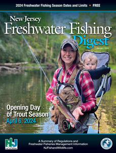
- Opening day of trout season: Saturday, April 6, 2024 at 8 a.m.
- To fish for trout or salmon, a valid New Jersey fishing license and trout stamp are both required for residents at least 16 years and less than 70 years of age plus all non-residents 16 years and older.
- All Brook Trout caught within the “Brook Trout Conservation Zone” must be immediately released unharmed. The zone consists of all waters within the northwest region of the state, where most remaining wild Brook Trout populations occur. The Conservation Zone includes all waters west of I-287 and north of Rt. 202, extending to, but not including the Delaware River. See map on Trout Fishing Regulations.
- Waters stocked with trout in the spring are listed below (those with no in-season closures) AND on Trout Fishing Regulations (those with in-season closures). Note: Special regulations may apply on some of these waters, or sections thereof.
- During the three weeks prior to opening day, all ponds, lakes or sections of streams listed are stocked with trout, except Trophy Trout Lakes. These waters are closed to fishing for all species from March 18 to April 6 at 8 a.m. Exceptions: Lake Hopatcong, Mountain Lake, Lake Shenandoah, Lawrence Brook (section from Davidson's Mill Rd. to Farrington Lake dam), Prospertown Lake and Swartswood Lake are open year round to fishing. However, all trout caught during this period (above) must be released immediately. Seasonal and Year-round Trout Conservation Areas and designated Holdover Trout Lakes (see Trout Fishing Regulations) are also open to fishing but are catch-and-release only for trout. Fishing is not permitted on Seasonal Trout Conservation Areas from 12:01 a.m. to 8 a.m. on April 6, 2024. Round Valley and Merrill Creek Reservoirs (Trophy Trout Lakes) are open to year-round fishing; trout may be harvested within the regulations as shown on Trout Fishing Regulations.
- After opening day, trout stocked waters are open to fishing, including the days they are stocked, unless specifically listed with in-season closures (Trout Fishing Regulations). In-season closures also apply to designated Seasonal Trout Conservation Areas (Trout Fishing Regulations).
- Only one daily creel limit of trout may be in possession. Once the creel limit is reached, an angler may continue to fish provided any additional trout caught are immediately returned to the water unharmed.
- When fishing from the shoreline, no more than three fishing rods, hand lines or combination thereof may be used. Separate stringers or buckets must be used for each angler’s catch.
- Containers in boats may hold only the combined daily creel limit for each legal angler on board.
- NJDEP Fish & Wildlife reserves the right to suspend stocking when emergency conditions prevail.
“Hook a Winner” Program
NJDEP Fish & Wildlife will be jaw-tagging more than 1,000 Rainbow Trout for release into New Jersey waters. These tagged trout will be stocked preseason to be available for opening day fishing. For more information visit dep.nj.gov/njfw/fishing/freshwater/hook-a-winner-program. If you are a lucky angler who lands one of these fish, send your name, address, fish tag number (do not send the actual tag) and location of catch to:
Attn: Hook a Winner Program
Pequest Trout Hatchery
605 Pequest Road,
Oxford, NJ 07863
In recognition of your catch, a certificate and award patch will be mailed.
Spring Trout Stocked Waters With No In-Season Fishing Closures
After opening day, these waters may be fished on the day they are stocked.
Note: All waters listed are stocked with trout pre-season (three-week period preceding opening day) except Round Valley and Merrill Creek Reservoirs. The number in parentheses shows the anticipated number of in-season stockings (April 8 through May 24). A zero indicates the water will be stocked only during pre-season. For weekly updates on stocking details, call the Trout Hotline’s recorded message at 609-322-9524. (Select waters are also stocked in the Fall (October) indicated by a "l" and Winter (November) indicated by a "s".) Or visit NJFishandWildlife.com where you will also find directions to public-access portions of trout-stocked waters.
Atlantic County
Birch Grove Park Ponds—Northfield (3) s
Hammonton Lake—Town of Hammonton (3) l
Heritage Pond—Absecon (3)
Bergen County
Dahnert’s Lake—Garfield (4)
Hackensack River—Lake Tappan to Harriot Ave., Harrington Park Borough (4)
Hohokus Brook—Parsons Pond Rd., Franklin Lakes Borough to Saddle River (4)
Indian Lake—Little Ferry Borough (4)
Mill Pond (aka Silver Lake)—SUSPENDED
Pascack Brook—Woodcliff Lake dam to Emerson Rd., Harrington Park Borough (4)
Potash Lake—Oakland (3)
Saddle River—Lake St. Upper Saddle River to West Century Rd., Fair Lawn (5)
Tenakill Brook—Closter Borough, entire length (3)
Whites Pond—Waldwick Borough (4)
Burlington County
Crystal Lake—Willingboro Twp. (4) l
Laurel Pond—Mt. Laurel Twp. (3)
Pemberton Lake—Pemberton Twp. (3)
Rancocas Creek, Southwest Br.— Mill St. Park to Rt. 70, Medford Twp. (4)
Sylvan Lake—Burlington Twp. (3) l
Camden County
Gloucester City Pond—Gloucester (4)
Grenloch Lake (see Gloucester County)
Haddon Lake—Audubon Borough (0) s
Oak Pond—Sicklerville, Winslow Twp. (3) l
Rowands Lake—Clementon Borough (3) s
Cape May County
Ponderlodge Pond —Villas, Lower Twp. (4) s
Tuckahoe Lake—Tuckahoe, Upper Twp. (4)
Cumberland County
Cohansey River—Dam at Seeleys Pond to powerline above Sunset Lake, Upper Deerfield Twp. (4)
Giampietro Park Lake—Vineland (0) l
Mary Elmer Lake—Bridgeton (3) l
Maurice River—Willow Grove Lake dam to Sherman Ave., Vineland (4) l
Shaws Mill Pond—Down/Lawrence Twps. (3) s
South Vineland Park Pond —Vineland (3) s
Essex County
Branch Brook Park Lake—Newark (4)
Diamond Mill Pond—Millburn Twp. (3)
Rahway River, W/Br.—Campbells Pond to Essex St., Milburn Twp. (3)
Verona Lake—Verona Twp. (4) l
Gloucester County
Greenwich Lake—Greenwich Twp. (3) l
Grenloch Lake—Washington Twp. (3) l
Harrisonville Lake—Pilesgrove/South Harrison Twps. (3)
Iona Lake—Franklin Twp. (3) l
Swedesboro Lake (aka Narraticon Lake)—Borough of Swedesboro (3) l
Westville Lake—Westville (0)
Hudson County
North Hudson Park Lake—(aka JJ Braddock Park Lake), North Bergen Twp. (4) l
West Hudson County Park Pond—Harrison (4)
Hunterdon County
Alexauken Creek—West Amwell Twp., entire length (2)
Amwell Lake—East Amwell Twp. (3) s
Capoolong Creek (aka Cakepoulin Creek)—Franklin Twp., entire length (5)
Delaware-Raritan Feeder Canal—source to Wilburtha Rd., Ewing Twp. (Mercer) (6)
Hakihokake Creek—Little York-Mount Pleasant Rd, Little York, Alexandria Twp. to Delaware River (2)
Lockatong Creek—Route 12, Kingwood Twp. to Delaware-Raritan Feeder Canal (5)
Mannys Pond—Union Twp. (3)
Mountain Farm Pond—Lebanon Twp. (3)
Mulhockaway Creek—Pattenburg, source to Spruce Run Reservoir, Clinton/Union Twps. (5)
Neshanic River—confluence of First and Second Neshanic Rivers to Rt. 514, Raritan Twp. (2)
Nishisakawick Creek—Frenchtown Alexandria Twp., entire length (2)
Rockaway Creek—Readington Twp., entire length (4)
Round Valley Reservoir—Clinton Twp. (1)
Sidney Brook—Franklin/Union Twps., entire length (1)
Spruce Run—Glen Gardner Borough/Lebanon Twp., entire length (5)
Stony Brook—(See Mercer Co.)
Wickecheoke Creek—Covered Bridge, Rt. 604, Sergeantsville to Delaware River (2)
Mercer County
Assunpink Creek—Assunpink Site 5 dam upstream of Rt. 130 to Carnegie Rd., Hamilton Twp. (4)
Colonial Lake—Lawrence Twp. (3) l
Delaware-Raritan Canal—Mulberry St., Trenton to Alexander St., Princeton (4)
Delaware-Raritan Feeder Canal—(See Hunterdon Co.) (6)
Rosedale Lake—Hopewell Twp. (3) l
Stony Brook—Hopewell Twp., entire length (4)
Middlesex County
Ireland Brook—500 ft. upstream of Riva Ave to Farrington Lake, North Brunswick Twp. (2)
Lake Papaianni—Edison Twp. (0)
Lawrence Brook—Dam at Davidson's Mill Pond to 2nd RR bridge (Raritan Railroad) below Main St., Milltown Borough, excluding Farrington Lake from Church Lane to Farrington Dam (4)
Manalapan Lake—Monroe Twp. (3)
Roosevelt Park Pond—Edison Twp. (3) l
Monmouth County
Echo Lake—Howell Twp. (3)
Englishtown Mill Pond (aka Weamaconk Lake)—Englishtown Borough (3)
Franklin Lake—West Long Branch Borough (3)
Garvey’s Pond—Middletown Twp. (3)
Hockhockson Brook—Rt. 18, Colts Neck Twp. to Garden State Parkway bridge (northbound), Tinton Falls Borough (5)
Holmdel Park Pond—Holmdel Twp. (3)
Mac’s Pond—Manasquan Borough (0)
Mingamahone Brook—Birdsall Rd. to Manasquan River, Howell Twp. (5)
Mohawk Pond—Red Bank Borough (4)
Shark River—Rt. 33, Wall Twp., to Remsen Mill Rd., Neptune/Wall Twp. (5)
Spring Lake—Spring Lake Borough (3) s
Topanemus Lake—Freehold Twp. (3) s
Yellow Brook—Heyers Mill Rd. to Muhlenbrink Rd., Colts Neck Twp. (2)
Morris County
Beaver Brook—Rockaway Twp./Borough, entire length (3)
Black River—Route 206 Chester, to the posted Black River Fish and Game club property at the lower end of Hacklebarney State Park (6) l
Burnham Park Ponds (Upper and Lower)—Town of Morristown (4)
Drakes Brook—Mt. Olive/Roxbury Twps., entire length (3)
Hibernia Brook—Rockaway Twp., entire length (5)
India Brook—Mountainside Ave. to Rt. 24, Mendham Borough (5)
Lake Hopatcong—Hopatcong/Jefferson/Mt. Arlington/Roxbury (3)
Lake Musconetcong—Netcong Borough/Roxbury Twp./Stanhope Borough (3)
Mt. Hope Pond—Rockaway Twp. (3) s
Passaic River—Black Brook confluence to Rt. 24, Chatham Borough (4)
Pequannock River—(see Passaic Co.)
Pompton River—(see Passaic Co.)
Russia Brook—Ridge Rd. to Lake Swannanoa, Jefferson Twp. (2)
Speedwell Lake—Town of Morristown (4) l
Whippany River—Tingley Rd., Morris Twp. to Ridgedale Ave., Town of Morristown (2)
Ocean County
Lake Shenandoah—Ocean Co. Park, Lakewood Twp. (3) s
Pohatcong Lake—Borough of Tuckerton (4)
Prospertown Lake—Jackson Twp. (3)
Passaic County
Barbour Pond—Woodland Park Borough (3) s
Clinton Reservoir—Newark Watershed, West Milford Twp. (3)
Green Turtle Lake—Long Pond Ironworks State Park, West Milford Twp. (3) s
Oldham Pond—North Haledon Borough (3)
Pequannock River—Rt. 23, Smith Mills to Paterson-Hamburg Turnpike, Pompton Lakes/Riverdale Boroughs (6)
Pompton River—confluence with Ramapo River to NY Susquehanna R.R. bridge, Wayne Twp. (4)
Ramapo River—Pompton Lake dam to confluence with Pompton River (4) l
Ringwood Brook—State line to Sally’s Pond, Ringwood State Park, Ringwood Borough (5)
Sheppard Lake—Ringwood State Park, Ringwood Borough (3)
Salem County
Harrisonville Lake—Pilesgrove/South Harrison Twps. (3)
Maurice River—Willow Grove Lake dam to Sherman Ave., Vineland (4)
Schadler’s Sand Wash Pond—Carneys Point Twp. (3) l
Somerset County
Lamington River—Rt. 523 (Lamington Rd.) Bedminster Twp. to Raritan River N. Br. (4)
Middle Brook, E/Br.—Bridgewater/Warren Twps., entire length (2)
Passaic River—(See Morris Co.)
Peapack Brook—Peapack-Gladstone Borough, entire length (5)
Raritan River—confluence of Raritan River N. Br. and S. Br. to Rt. 206, Hillsborough Twp./Somerville Borough (4)
Rock Brook—Hillsborough/Montgomery Twps., entire length (1)
Spooky Brook Park Pond—Franklin Twp. (0)
Sussex County
Alm’s House Pond—Frankford Twp. (3)
Andover Junction Brook—Andover Borough, entire length (2)
Big Flat Brook, Upper—Sawmill Pond, High Point State Park, Montague Twp. to 100 ft. above Crigger Rd., Stokes State Forest, Sandyston Twp. (4)
Blue Mountain Lake—Delaware Water Gap Nat’l Recreation Area, Walpack Twp. (3)
Clove Brook—source to Clove Acres Lake, Wantage Twp. (5)
Culver’s Creek—Frankford Twp., entire length (2)
Dry Brook—Branchville Borough/Frankford Twp., entire length (3)
Franklin Pond Creek—Hamburg Mtn. WMA, Hardyston Twp./Franklin Borough, entire length (5)
Glenwood Brook—Glenwood Lake dam to state line (2)
Lake Aeroflex—Andover Twp. (3) s
Lake Hopatcong—Hopatcong/Mt Arlington Boroughs, Jefferson/Roxbury Twps. (3)
Lake Musconetcong—Netcong/Stanhope Boroughs/Roxbury Twp. (3)
Lake Ocquittunk—Stokes State Forest, Sandyston Twp. (3) s
Little Flat Brook—Sandyston Twp., entire length (5)
Little Swartswood Lake—Hampton Twp. (3) s
Lubbers Run—Byram Twp., entire length (5)
Neldon Brook—Stillwater Twp., entire length (2)
Papakating Creek—George Hill Rd., Frankford Twp. to Rt. 565, Lewisburg (2)
Papakating Creek, W/Br.—Wantage Twp., entire length (2)
Pond Brook—Stillwater Twp., entire length (5)
Sawmill Pond—High Point State Park, Montague Twp. (3)
Silver Lake—Hamburg Mountain WMA, Hardyston Twp. (0) s
Stony Lake—Stokes State Forest, Sandyston Twp. (3)
Swartswood Lake—Stillwater Twp. (3)
Wallkill River—Lake Mohawk Dam to Route 23, Hardyston Twp. (4-5) l
Wawayanda Creek—Vernon Twp., entire length (5)
Wawayanda Lake—Vernon Twp. (3)
Union County
Green Brook—Rt. 527, Berkeley Heights Twp. to Rt. 22, Scotch Plains Twp. (2)
Lower Echo Lake—Mountainside Borough (3) l
Milton Lake—Rahway (4)
Nomahegan Park Lake—Cranford Twp. (4)
Passaic River—(See Morris Co.)
Rahway River—I-78 bridge, Springfield to Lawrence St. (Route 514), Rahway (4)
Seeleys Pond—Berkeley Heights Twp. (3)
Warinanco Park Lake—Roselle Borough (0)
Warren County
Beaver Brook—Silver Lake Dam to Pequest River, White Twp. (4)
Blair Creek—Bass Lake dam, Hardwick Twp. to Blair Lake, Blairstown Twp. (2)
Blair Lake—Blairstown Twp. (3)
Brookaloo Swamp—Hope Twp., entire length (2)
Buckhorn Creek—Harmony Twp., entire length (2)
Furnace Brook—Oxford Twp., entire length (2)
Furnace Lake—Oxford Twp. (3) s
Honey Run— Knowlton-Hope township line to Beaver Brook, Hope Twp. (2)
Jacksonburg Creek—Blairstown Twp., entire length (2)
Lopatcong Creek—Rt. 519 Harmony Twp., to South Main St., Phillipsburg (5)
Merrill Creek Reservoir—Harmony Twp. (1)
Mountain Lake—Liberty Twp. (0)
Pohatcong Creek—source to Rt. 31, Washington Twp. (2)
Pophandusing Creek—White Twp., entire length (2)
White Lake—Hardwick Twp. (3)